Arrondissement of Saint-Flour
Arrondissement in Auvergne-Rhône-Alpes, France From Wikipedia, the free encyclopedia
Arrondissement in Auvergne-Rhône-Alpes, France From Wikipedia, the free encyclopedia
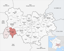
The arrondissement of Saint-Flour is an arrondissement of France in the Cantal department in the Auvergne-Rhône-Alpes region. It has 98 communes.[2] Its population is 37,697 (2016), and its area is 2,510.6 km2 (969.3 sq mi).[3]
Saint-Flour | |
|---|---|
 Location within the region Auvergne-Rhône-Alpes | |
| Country | France |
| Region | Auvergne-Rhône-Alpes |
| Department | Cantal |
| No. of communes | 98 |
| Subprefecture | Saint-Flour |
| Area | 2,510.6 km2 (969.3 sq mi) |
| Population (2021)[1] | 36,904 |
| • Density | 15/km2 (40/sq mi) |
| INSEE code | 153 |
The communes of the arrondissement of Saint-Flour, and their INSEE codes, are:[2]
The arrondissement of Saint-Flour was created in 1800.[4]
As a result of the reorganisation of the cantons of France which came into effect in 2015, the borders of the cantons are no longer related to the borders of the arrondissements. The cantons of the arrondissement of Saint-Flour were, as of January 2015:[5]
Seamless Wikipedia browsing. On steroids.
Every time you click a link to Wikipedia, Wiktionary or Wikiquote in your browser's search results, it will show the modern Wikiwand interface.
Wikiwand extension is a five stars, simple, with minimum permission required to keep your browsing private, safe and transparent.