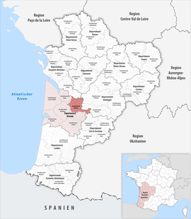
The arrondissement of Libourne is an arrondissement of France in the Gironde department in the Nouvelle-Aquitaine region. It has 129 communes.[2] Its population is 154,067 (2016), and its area is 1,282.9 km2 (495.3 sq mi).[3]
Libourne | |
|---|---|
 Location within the region Nouvelle-Aquitaine | |
| Country | France |
| Region | Nouvelle-Aquitaine |
| Department | Gironde |
| No. of communes | 129 |
| Subprefecture | Libourne |
| Area | 1,282.9 km2 (495.3 sq mi) |
| Population (2021)[1] | 156,142 |
| • Density | 122/km2 (320/sq mi) |
| INSEE code | 335 |
Composition
The communes of the arrondissement of Libourne, and their INSEE codes, are:[2]
- Abzac (33001)
- Les Artigues-de-Lussac (33014)
- Arveyres (33015)
- Asques (33016)
- Baron (33028)
- Bayas (33034)
- Belvès-de-Castillon (33045)
- Les Billaux (33052)
- Bonzac (33062)
- Bossugan (33064)
- Branne (33071)
- Cabara (33078)
- Cadarsac (33079)
- Cadillac-en-Fronsadais (33082)
- Camiac-et-Saint-Denis (33086)
- Camps-sur-l'Isle (33088)
- Caplong (33094)
- Castillon-la-Bataille (33108)
- Chamadelle (33124)
- Civrac-sur-Dordogne (33127)
- Coubeyrac (33133)
- Coutras (33138)
- Daignac (33147)
- Dardenac (33148)
- Doulezon (33153)
- Les Églisottes-et-Chalaures (33154)
- Espiet (33157)
- Eynesse (33160)
- Le Fieu (33166)
- Flaujagues (33168)
- Francs (33173)
- Fronsac (33174)
- Galgon (33179)
- Gardegan-et-Tourtirac (33181)
- Génissac (33185)
- Gensac (33186)
- Gours (33191)
- Grézillac (33194)
- Guillac (33196)
- Guîtres (33198)
- Izon (33207)
- Jugazan (33209)
- Juillac (33210)
- La Roquille (33360)
- Lagorce (33218)
- Lalande-de-Pomerol (33222)
- La Lande-de-Fronsac (33219)
- Lapouyade (33230)
- Les Lèves-et-Thoumeyragues (33242)
- Libourne (33243)
- Ligueux (33246)
- Lugaignac (33257)
- Lugon-et-l'Île-du-Carnay (33259)
- Lussac (33261)
- Maransin (33264)
- Margueron (33269)
- Montagne (33290)
- Mouillac (33295)
- Mouliets-et-Villemartin (33296)
- Moulon (33298)
- Naujan-et-Postiac (33301)
- Néac (33302)
- Nérigean (33303)
- Les Peintures (33315)
- Périssac (33317)
- Pessac-sur-Dordogne (33319)
- Petit-Palais-et-Cornemps (33320)
- Pineuilh (33324)
- Pomerol (33328)
- Porchères (33332)
- Puisseguin (33342)
- Pujols (33344)
- Puynormand (33347)
- Rauzan (33350)
- Riocaud (33354)
- La Rivière (33356)
- Sablons (33362)
- Saillans (33364)
- Saint-Aignan (33365)
- Saint-André-et-Appelles (33369)
- Saint-Antoine-sur-l'Isle (33373)
- Saint-Aubin-de-Branne (33375)
- Saint-Avit-de-Soulège (33377)
- Saint-Avit-Saint-Nazaire (33378)
- Saint-Christophe-de-Double (33385)
- Saint-Christophe-des-Bardes (33384)
- Saint-Cibard (33386)
- Saint-Ciers-d'Abzac (33387)
- Saint-Denis-de-Pile (33393)
- Sainte-Colombe (33390)
- Sainte-Florence (33401)
- Sainte-Foy-la-Grande (33402)
- Saint-Émilion (33394)
- Sainte-Radegonde (33468)
- Sainte-Terre (33485)
- Saint-Étienne-de-Lisse (33396)
- Saint-Genès-de-Castillon (33406)
- Saint-Genès-de-Fronsac (33407)
- Saint-Germain-de-la-Rivière (33414)
- Saint-Germain-du-Puch (33413)
- Saint-Hippolyte (33420)
- Saint-Jean-de-Blaignac (33421)
- Saint-Laurent-des-Combes (33426)
- Saint-Magne-de-Castillon (33437)
- Saint-Martin-de-Laye (33442)
- Saint-Martin-du-Bois (33445)
- Saint-Médard-de-Guizières (33447)
- Saint-Michel-de-Fronsac (33451)
- Saint-Pey-d'Armens (33459)
- Saint-Pey-de-Castets (33460)
- Saint-Philippe-d'Aiguille (33461)
- Saint-Philippe-du-Seignal (33462)
- Saint-Quentin-de-Baron (33466)
- Saint-Quentin-de-Caplong (33467)
- Saint-Romain-la-Virvée (33470)
- Saint-Sauveur-de-Puynormand (33472)
- Saint-Seurin-sur-l'Isle (33478)
- Saint-Sulpice-de-Faleyrens (33480)
- Saint-Vincent-de-Pertignas (33488)
- Les Salles-de-Castillon (33499)
- Savignac-de-l'Isle (33509)
- Tarnès (33524)
- Tayac (33526)
- Tizac-de-Curton (33531)
- Tizac-de-Lapouyade (33532)
- Vayres (33539)
- Vérac (33542)
- Vignonet (33546)
- Villegouge (33548)
History
The arrondissement of Libourne was created in 1800.[4]
As a result of the reorganisation of the cantons of France which came into effect in 2015, the borders of the cantons are no longer related to the borders of the arrondissements. The cantons of the arrondissement of Libourne were, as of January 2015:[5]
- Branne
- Castillon-la-Bataille
- Coutras
- Fronsac
- Guîtres
- Libourne
- Lussac
- Pujols
- Sainte-Foy-la-Grande
References
Wikiwand in your browser!
Seamless Wikipedia browsing. On steroids.
Every time you click a link to Wikipedia, Wiktionary or Wikiquote in your browser's search results, it will show the modern Wikiwand interface.
Wikiwand extension is a five stars, simple, with minimum permission required to keep your browsing private, safe and transparent.
