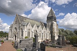
Anvin
Commune in Hauts-de-France, France From Wikipedia, the free encyclopedia
Commune in Hauts-de-France, France From Wikipedia, the free encyclopedia
Anvin (French pronunciation: [ɑ̃vɛ̃]) is a commune in the Pas-de-Calais department in northern France.[3]
Anvin | |
|---|---|
 The church of Anvin | |
| Coordinates: 50°26′50″N 2°15′22″E | |
| Country | France |
| Region | Hauts-de-France |
| Department | Pas-de-Calais |
| Arrondissement | Arras |
| Canton | Saint-Pol-sur-Ternoise |
| Intercommunality | CC du Ternois |
| Government | |
| • Mayor (2020–2026) | André Olivier[1] |
| Area 1 | 7.83 km2 (3.02 sq mi) |
| Population (2021)[2] | 726 |
| • Density | 93/km2 (240/sq mi) |
| Time zone | UTC+01:00 (CET) |
| • Summer (DST) | UTC+02:00 (CEST) |
| INSEE/Postal code | 62036 /62134 |
| Elevation | 51–150 m (167–492 ft) (avg. 60 m or 200 ft) |
| 1 French Land Register data, which excludes lakes, ponds, glaciers > 1 km2 (0.386 sq mi or 247 acres) and river estuaries. | |
Anvin is a farming village located in the Ternoise river valley, 28 miles (44 km) northwest of Arras, at the junction of the D343, D70 and D94 roads.
The inhabitants are called Anvinois in French.
| Year | Pop. | ±% p.a. |
|---|---|---|
| 1968 | 615 | — |
| 1975 | 587 | −0.66% |
| 1982 | 639 | +1.22% |
| 1990 | 666 | +0.52% |
| 1999 | 741 | +1.19% |
| 2009 | 803 | +0.81% |
| 2014 | 778 | −0.63% |
| 2020 | 736 | −0.92% |
| Source: INSEE[4] | ||
The Chemin de fer d'Anvin à Calais opened a railway station at Anvin in 1881.[5] The railway closed in 1952.[6] Anvin station was also served by the SNCF. Although the line is still open to traffic, the station is closed.
Seamless Wikipedia browsing. On steroids.
Every time you click a link to Wikipedia, Wiktionary or Wikiquote in your browser's search results, it will show the modern Wikiwand interface.
Wikiwand extension is a five stars, simple, with minimum permission required to keep your browsing private, safe and transparent.