Orval (Cher)
französische Gemeinde im Département Cher Aus Wikipedia, der freien Enzyklopädie
| Orval | ||
|---|---|---|

| ||
| Staat | Frankreich | |
| Region | Centre-Val de Loire | |
| Département (Nr.) | Cher (18) | |
| Arrondissement | Saint-Amand-Montrond | |
| Kanton | Saint-Amand-Montrond | |
| Gemeindeverband | Cœur de France | |
| Koordinaten | 46° 44′ N, 2° 29′ O | |
| Höhe | 152–288 m | |
| Fläche | 7,65 km² | |
| Einwohner | 1.637 (1. Januar 2022) | |
| Bevölkerungsdichte | 214 Einw./km² | |
| Postleitzahl | 18200 | |
| INSEE-Code | 18172 | |
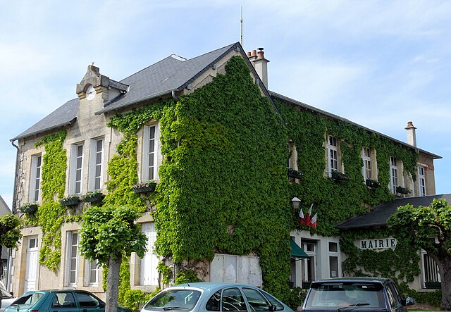
 Rathaus von Orval | ||
Orval ist eine französische Gemeinde mit 1.637 Einwohnern (Stand: 1. Januar 2022) im Département Cher in der Region Centre-Val de Loire; sie gehört zum Arrondissement Saint-Amand-Montrond und zum Kanton Saint-Amand-Montrond.
Geographie
Orval liegt etwa 40 Kilometer südsüdöstlich von Bourges am Cher. Umgeben wird Orval von den Nachbargemeinden Saint-Amand-Montrond im Norden und Osten, Bouzais im Süden, Orcenais im Westen sowie Nozières im Nordwesten.
Durch die Gemeinde führen die Autoroute A71 und die frühere Route nationale 725 (heutige D925).
Bevölkerungsentwicklung
| 1962 | 1968 | 1975 | 1982 | 1990 | 1999 | 2006 | 2012 | 2018 |
|---|---|---|---|---|---|---|---|---|
| 1216 | 1436 | 1995 | 2055 | 2024 | 1997 | 1898 | 1884 | 1806 |
Sehenswürdigkeiten

- Kirche Saint-Hilaire aus dem 13. Jahrhundert
Persönlichkeiten
- Die Herrschaft über Orval übte lange Zeit das Haus Albret aus.
- Odet de Foix (1485–1528), Marschall Frankreichs, Herr über Orval
Literatur
- Le Patrimoine des Communes du Cher. Flohic Editions, Band 2, Paris 2001, ISBN 2-84234-088-4, S. 743–745.
Weblinks
Commons: Orval – Sammlung von Bildern, Videos und Audiodateien
Wikiwand - on
Seamless Wikipedia browsing. On steroids.

