Congerville-Thionville
französische Gemeinde Aus Wikipedia, der freien Enzyklopädie
Congerville-Thionville ist eine französische Gemeinde mit 212 Einwohnern (Stand: 1. Januar 2022) im Département Essonne in der Region Île-de-France; sie gehört zum Arrondissement Étampes und zum Kanton Étampes. Die Einwohner werden Congervillois-Thionvillois genannt.
| Congerville-Thionville | ||
|---|---|---|
| Staat | Frankreich | |
| Region | Île-de-France | |
| Département (Nr.) | Essonne (91) | |
| Arrondissement | Étampes | |
| Kanton | Étampes | |
| Gemeindeverband | Étampois Sud Essonne | |
| Koordinaten | 48° 23′ N, 1° 59′ O | |
| Höhe | 113–151 m | |
| Fläche | 8,47 km² | |
| Einwohner | 212 (1. Januar 2022) | |
| Bevölkerungsdichte | 25 Einw./km² | |
| Postleitzahl | 91740 | |
| INSEE-Code | 91613 | |
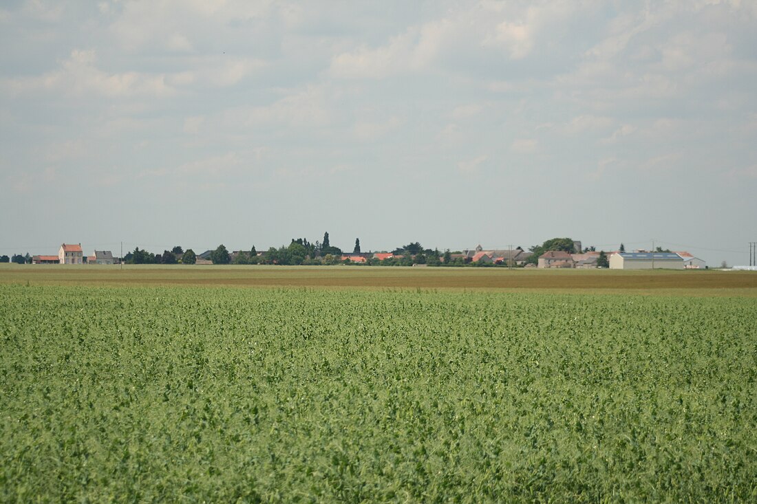
 Blick auf Congervile-Thionville | ||
Geographie
Congerville-Thionville liegt etwa 59 Kilometer südsüdwestlich von Paris und etwa 14 Kilometer südwestlich von Étampes. Umgeben wird Congerville-Thionville von den Nachbargemeinden Mérobert im Norden, Chalou-Moulineux im Osten, Pussay im Süden, Gommerville im Südwesten sowie Oysonville im Westen.
Durch die Gemeinde führt die frühere Route nationale 838 (heutige D838).
Geschichte
Die beiden Gemeindeteile Congerville und Thionville sind im 12. bzw. 13. Jahrhundert erstmals urkundlich erwähnt worden. Zusammengeschlossen wurden die Kommunen 1973.
Bevölkerungsentwicklung
| Jahr | 1962 | 1968 | 1975 | 1982 | 1990 | 1999 | 2006 | 2012 | 2019 |
| Einwohner | 194 | 178 | 176 | 159 | 187 | 225 | 221 | 232 | 216 |
| Quellen: Cassini und INSEE | |||||||||
Sehenswürdigkeiten
- Kirche Saint-Gilles
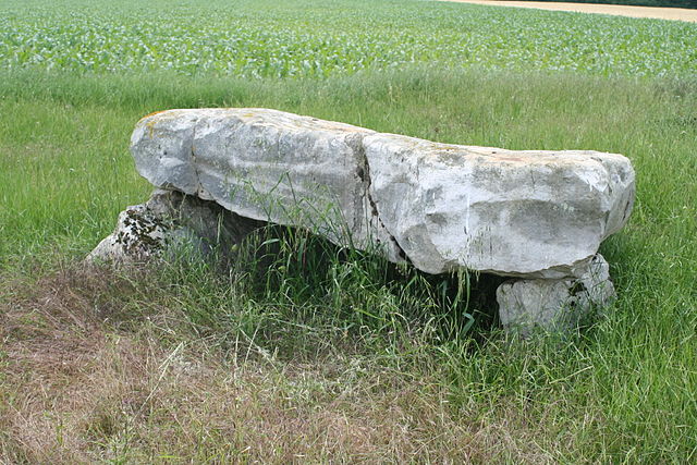
- Der Dolmen le Grès de Linas aus der Jungsteinzeit, Monument historique seit 1970

Literatur
- Le Patrimoine des Communes de l’Essonne. Flohic Éditions, Band 2, Paris 2001, ISBN 2-84234-126-0, S. 650–652.
Weblinks
Commons: Congerville-Thionville – Sammlung von Bildern, Videos und Audiodateien
Wikiwand - on
Seamless Wikipedia browsing. On steroids.

