Loading AI tools
Žitavany ist eine Gemeinde in der Mittelslowakei nördlich der Stadt Zlaté Moravce.
| Žitavany | ||
|---|---|---|
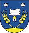
| Wappen | Karte | |
 |
||
| Basisdaten | ||
| Staat: | ||
| Kraj: | Nitriansky kraj | |
| Okres: | Zlaté Moravce | |
| Region: | Nitra | |
| Fläche: | 18,202 km² | |
| Einwohner: | 1.823 (31. Dez. 2022) | |
| Bevölkerungsdichte: | 100 Einwohner je km² | |
| Höhe: | 235 m n.m. | |
| Postleitzahl: | 951 97 | |
| Telefonvorwahl: | 0 37 | |
| Geographische Lage: | 48° 24′ N, 18° 25′ O | |
| Kfz-Kennzeichen (vergeben bis 31.12.2022): |
ZM | |
| Kód obce: | 582816 | |
| Struktur | ||
| Gemeindeart: | Gemeinde | |
| Verwaltung (Stand: Oktober 2022) | ||
| Bürgermeister: | Pavel Chren | |
| Adresse: | Obecný úrad Žitavany Športová 5 95197 Žitavany | |
| Webpräsenz: | www.zitavany.sk | |
Sie entstand 1958 aus den Orten Kňažice (deutsch Kneschitz) und Opatovce nad Žitavou (Klein-Opatowetz) und gehörte von 1975 bis 2002 als Stadtteil zu Zlaté Moravce.
- Géza Polónyi (1848–1920), ungarischer Politiker, Jurist und Justizminister
Wikiwand in your browser!
Seamless Wikipedia browsing. On steroids.
Every time you click a link to Wikipedia, Wiktionary or Wikiquote in your browser's search results, it will show the modern Wikiwand interface.
Wikiwand extension is a five stars, simple, with minimum permission required to keep your browsing private, safe and transparent.
