Delwedd:Derwentcroped.jpg
From Wikipedia, the free encyclopedia
Derwentcroped.jpg ((224 × 453 picsel, maint y ffeil: 19 KB, ffurf MIME: image/jpeg))
Daw'r ffeil hon o Comin Wikimedia a gellir ei defnyddio gan brosiectau eraill. Dangosir isod y disgrifiad sydd ar dudalen ddisgrifio'r ffeil yno.
Crynodeb
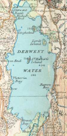
Derwent Water on a 1925 Ordnance Survey map
- This work is in the public domain because it is an Ordnance Survey map over 50 years old. Ordnance Survey maps are covered by crown copyright which in this case expires 50 years after publication. Ordnance Survey does however ask that they be credited and that the date of publication be given. Any ancillary rights gained through the creation of the electronic version are granted as freely usable under any circumstances.
Trwyddedu
This work is an Ordnance Survey map over 50 years old, which is covered by Crown Copyright which in this case expires 50 years after publication. Ordnance Survey does however ask that they be credited and that the date of publication be given.
Any ancillary rights gained through the creation of the electronic version are granted as freely usable under any circumstances.
|
| Public domainPublic domainfalsefalse |
This work created by the United Kingdom Government is in the public domain.
This is because it is one of the following:
HMSO has declared that the expiry of Crown Copyrights applies worldwide (ref: HMSO Email Reply) Deutsch ∙ English ∙ Español ∙ français ∙ italiano ∙ Nederlands ∙ polski ∙ português ∙ sicilianu ∙ slovenščina ∙ suomi ∙ Türkçe ∙ македонски ∙ русский ∙ українська ∙ മലയാളം ∙ 한국어 ∙ 日本語 ∙ 简体中文 ∙ 繁體中文 ∙ العربية ∙ +/− |
 |
Captions
Items portrayed in this file
yn portreadu
Hanes y ffeil
Cliciwch ar ddyddiad / amser i weld y ffeil fel ag yr oedd bryd hynny.
| Dyddiad / Amser | Bawdlun | Hyd a lled | Defnyddiwr | Sylw | |
|---|---|---|---|---|---|
| cyfredol | 22:22, 17 Hydref 2006 | | 224 × 453 (19 KB) | Voyager | == Summary == Derwent Water on a 1925 Ordnance Survey map :This work is in the public domain because it is an Ordnance Survey map over 50 years old. Ordnance Survey maps are covered by crown copyright which in this case expires 50 years after publication |
Cysylltiadau'r ffeil
Mae'r 1 tudalennau a ddefnyddir isod yn cysylltu i'r ddelwedd hon:
Defnydd cydwici y ffeil
Mae'r wicis eraill hyn yn defnyddio'r ffeil hon:
- Y defnydd ar de.wikipedia.org
- Y defnydd ar it.wikipedia.org
- Y defnydd ar nl.wikipedia.org
- Y defnydd ar nn.wikipedia.org
- Y defnydd ar pnb.wikipedia.org
- Y defnydd ar ru.wikipedia.org
- Y defnydd ar simple.wikipedia.org
Metadata
Mae'r ffeil hon yn cynnwys gwybodaeth ychwanegol, sydd mwy na thebyg wedi dod o'r camera digidol neu'r sganiwr a ddefnyddiwyd i greu'r ffeil neu ei digido. Os yw'r ffeil wedi ei cael ei newid ers ei chreu efallai nad yw'r manylion hyn yn dal i fod yn gywir.
| _error | 0 |
|---|