Utsjoki
Obec v provincii Laponsko ve Finsku. From Wikipedia, the free encyclopedia
Obec v provincii Laponsko ve Finsku. From Wikipedia, the free encyclopedia
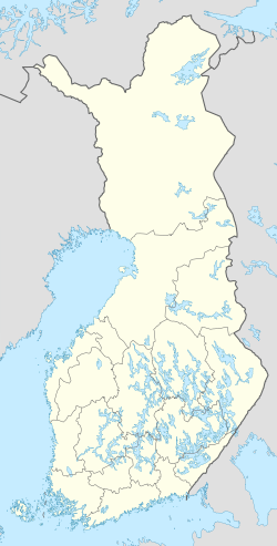
Utsjoki (severosámsky Ohcejohka, inarijskou sámštinou Uccjuuhâ, skoltskou sámštinou Uccjokk) je čtvrtá nejsevernější obec Finska (po vesnicích Kaava, Vetsikko a Nuorgam). Její území leží na hranici s Norskem na severu provincie Lappi. Na jihu hraničí s územím obce Inari. Obec byla založena roku 1876.
| Utsjoki Utsjoen kunta | |
|---|---|
 | |
 znak | |
| Poloha | |
| Souřadnice | 69°54′28″ s. š., 27°1′36″ v. d. |
| Časové pásmo | UTC+02:00 (standardní čas) UTC+03:00 (letní čas) |
| Stát | |
 Utsjoki | |
| Rozloha a obyvatelstvo | |
| Rozloha | 5 147,2 km² |
| Počet obyvatel | 1 139 (2023)[1] |
| Hustota zalidnění | 0,2 obyv./km² |
| Správa | |
| Vznik | 1876 |
| Oficiální web | www |
| Některá data mohou pocházet z datové položky. | |
Počet obyvatel obce je 1 385 (2003). Rozloha činí 5 370,5 km², z čehož 202,93 km² připadá na vodní plochy. Hustota zalidnění je 0,25 obyvatel na km²2. Utsjoki má dva úřední jazyky: Severní sámštinu a finštinu. Je to jediná obec ve Finsku, v níž většina populace je sámskojazyčná.

Hranice mezi Norskem a Finskem probíhá řekou Tenojoki, která teče do Severního ledového oceánu. Řeka je bohatá na lososy, pročež je oblíbeným místem pro sportovní rybaření. Nejsevernějším místem Finska je vesnice Nuorgam (severos. Njuorggán), která je rovněž nejsevernějším hraničním přechodem na světě. Na území Utsjoki se nachází přírodní rezervace Kevo (712 km²; 63 km turistických tras).
Seamless Wikipedia browsing. On steroids.
Every time you click a link to Wikipedia, Wiktionary or Wikiquote in your browser's search results, it will show the modern Wikiwand interface.
Wikiwand extension is a five stars, simple, with minimum permission required to keep your browsing private, safe and transparent.

