Saint Helena Island (pulo sa Santaylena)
pulo sa Saint Helena From Wikipedia, the free encyclopedia
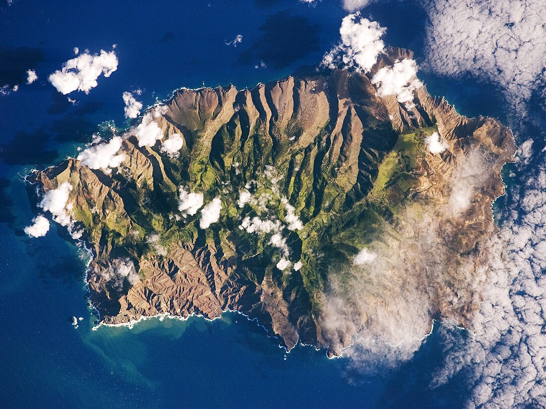
Pulo ang Saint Helena Island sa Santaylena (Hiniusang Gingharian).[1] Nahimutang ni sa administratibong yunit sa Santaylena, sa amihanan-sidlakang bahin sa nasod, 3 km sa habagatan sa Jamestown ang ulohan sa nasod. Naglangkob kin og 127 ka kilometro kwadrado.
- Alang sa ubang mga dapit sa mao gihapon nga ngalan, tan-awa ang Saint Helena Island.
| Santaylena Island | |
| Santaylena, Island of Saint Helena | |
| Pulo | |
| Teritoryo | Santaylena, Hiniusang Gingharian |
|---|---|
| Administratibong yunit | Santaylena |
| Gitas-on | 620 m (2,034 ft) |
| Tiganos | 15.96463°S 5.70671°W |
| Area | 126.68 km2 (49 sq mi) |
| Timezone | UTC (UTC+0) |
| GeoNames | 3370750 |
Ang yuta sa Santaylena Island kay kabungtoran.[saysay 1] Ang labing taas nga punto sa pulo mao ang 789 metros ibabaw sa dagat nga lebel. Naglukop ni og 13.8 km gikan sa amihanan ngadto sa habagatan ug 16.5 km gikan sa sidlakan ngadto sa kasadpan.[saysay 2]
Mga lungsod sa Santaylena Island:
Sa mosunod nga mga natural nga mga bahin makita sa Santaylena Island:
- Mga luuk:
- Deep Valley Bay (luuk)
- Long Cove (luuk)
- Manati Bay (luuk)
- Potato Bay (luuk)
- Powell Bay (luuk)
- Sandy Bay (luuk)
- Shepherds Hole (luuk)
- Stone Top Bay (luuk)
- Busay:
- Waterfall (busay)
- Mga tubud:
- Lots Wife Ponds (lanaw)
- Mga patag:
- Deadwood Plain (patag)
- Donkey Plain (patag)
- Horse Pasture (patag)
- Longwood Plain (patag)
- Prosperous Bay Plain (patag)
- Nga bato nga pormasyon:
- Billy Birch (bato)
- Coles Rock (bato)
- Flat Rock (bato)
- Frightus Rock (bato)
- Goat Pound Ridge (pangpang)
- Hoopers Rock (bato)
- Jar (bato)
- Ladies Chair (bato)
- Landing Rock (bato)
- Lot (bato)
- Lots Wife (bato)
- Man and Horse Cliffs (pangpang)
- Spyglass (bato)
- The Asses Ears (bato)
- The Bell Stone (bato)
- The Buoys (mga bato)
- The Chimney (bato)
- The Friar (bato)
- The Lion (bato)
- The Needle (bato)
- White Rocks (bato)
- Mga bungtod:
- Alarm Hill (bungtod)
- Banks Ridge (tagaytay)
- Beach Hill (bungtod)
- Blue Hill (bungtod)
- Bonfire Ridge (tagaytay)
- Bunkers Hill (tagaytay)
- Devils Hole Ridge (tagaytay)
- Friars Ridge (tagaytay)
- Goughs Ledge (tagaytay)
- Green Hill (bungtod)
- High Knoll (bungtod)
- High Ridge (tagaytay)
- Hoopers Ridge (tagaytay)
- Horse Ridge (tagaytay)
- Joan Hill (bungtod)
- Knotty Ridge (tagaytay)
- Ladder Hill (bungtod)
- Lazy Point (tagaytay)
- Long Ground Ridge (tagaytay)
- Mount Eternity (bungtod)
- Mount Ross (bungtod)
- Narrow Ridge (tagaytay)
- Peak Hill (bungtod)
- Powells Valley Hill (bungtod)
- Rose Hill (bungtod)
- Ruperts Hill (bungtod)
- Sandy Bay Barn (bungtod)
- Sandy Bay Ridge (tagaytay)
- Scotts Hill (bungtod)
- Silver Hill (bungtod)
- Stitch's Ridge (tagaytay)
- Stone Top Ridge (tagaytay)
- The Spyglass (bungtod)
- Tipleys Ridge (tagaytay)
- Tobys Ledge (bungtod)
- White Hill (bungtod)
- Woody Point (bungtod)
- Mga lawis:
- Benmillet (punta)
- Bennetts Point (punta)
- Castle Rock Point (punta)
- Crown Point (punta)
- Hickshall Point (punta)
- Horses Head (punta)
- Long Point (punta)
- Long Range Point (punta)
- New Point (punta)
- Old Father Point (punta)
- Old Joan Point (punta)
- Powell Point (punta)
- Rainy Point (punta)
- Rough Rock (punta)
- The Barn (punta)
- West Point (punta)
- White Hill Point (punta)
- Mga walog:
- Banks Valley (lugut)
- Bevins Gut (lugut)
- Bilberry Field Gut (lugut)
- Breakneck Valley (lugut)
- Broad Bottom Gut (lugut)
- Broad Gut (lugut)
- Cat Hole (lugut)
- Deep Valley (lugut)
- Devils Hole (lugut)
- Dry Gut (lugut)
- Dry Gut (lugut)
- Fishers Valley (lugut)
- Friars Valley (lugut)
- James Valley (lugut)
- Lemon Tree Gut (lugut)
- Lemon Tree Gut (lugut)
- Lemon Valley (lugut)
- Mulberry Gut (lugut)
- Netley Gut (lugut)
- Old Womans Valley (lugut)
- Paitrig Gut (lugut)
- Peak Gut (lugut)
- Pleasant Valley (lugut)
- Powells Gut (lugut)
- Rural Retreat Gut (lugut)
- Salt Gut (lugut)
- Sane Valley (lugut)
- Sharks Valley (lugut)
- Sheep Pound Gut (lugut)
- Swanley Valley (lugut)
- The Gates of Chaos (lugut)
- Thompsons Valley (lugut)
- Warrens Gut (lugut)
- Water Gut (lugut)
- Woodlands Gut (lugut)
- Youngs Valley (lugut)
- Kabukiran:
- Bencoolen (bukid)
- Blue Point (bukid)
- Botleys Point (bukid)
- Boxwood Hill (bukid)
- Cuckholds Point (tumoy sa bukid)
- Devils Cap (bukid)
- Diana Peak (tumoy sa bukid)
- Flagstaff Hill (bukid)
- Halleys Mount (bukid)
- High Hill (bukid)
- High Peak (bukid)
- Little Stone Top (bukid)
- Long Range (bukid)
- Mount Actaeon (bukid)
- Mount Vesey (bukid)
- Sheep Knoll (bukid)
- The Depot (bukid)
- The Haystack (tumoy sa bukid)
- Thompsons Hill (bukid)
- West Point (bukid)
- White Point (bukid)
- Wild Ram Hill (bukid)
- Woodlands Hill (bukid)
- Kagaangan:
- Mga gintang:
- Great Hollow (gintang nga angkasanan)
- The Saddle (gintang nga angkasanan)
- Two Gun Saddle (gintang)
Ang klima uga. Ang kasarangang giiniton 19 °C. Ang kinainitan nga bulan Enero, sa 24 °C, ug ang kinabugnawan Hulyo, sa 14 °C.[3] Ang kasarangang pag-ulan 25 milimetro matag tuig. Ang kinabasaan nga bulan Marso, sa 7 milimetro nga ulan, ug ang kinaugahan Mayo, sa 1 milimetro.[4]
Saysay
Ang mga gi basihan niini
Wikiwand - on
Seamless Wikipedia browsing. On steroids.


