Payl:Czech_Republic_districts.png
From Wikipedia, the free encyclopedia
Gidak-on ning maong paunang tan-aw: 800 x 540 ka mga piksel. Uban pang mga resoluyon: 320 x 216 ka mga piksel | 640 x 432 ka mga piksel | 1,024 x 692 ka mga piksel | 1,300 x 878 ka mga piksel.
Tibuok resolusyon (1,300 × 878 pixels, size sa payl: 42 KB, MIME type: image/png)
Kining maong payl gikan sa Wikimedia Commons ug mahimong gigamit sa ubang proyekto. Ang deskripsyon niini didto gipakita sa ubos.
Mubong sugid:
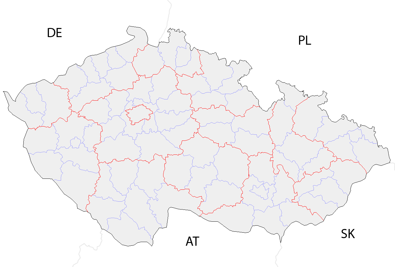
| DeskripsyonCzech Republic districts.png | Map of the districts of the Czech Republic showing former district borders before December 31, 2006. Created by Rarelibra 18:42, 29 December 2006 (UTC) for public domain use, using MapInfo Professional v8.5 and various mapping resources. |
| Petsa | 29 Disyembre 2006 (original upload date) |
| Gigikanan | No machine-readable source provided. Own work assumed (based on copyright claims). |
| Tagsulat | No machine-readable author provided. Rarelibra assumed (based on copyright claims). |
Pagtugot
| Public domainPublic domainfalsefalse |
| I, the copyright holder of this work, release this work into the public domain. This applies worldwide. In some countries this may not be legally possible; if so: I grant anyone the right to use this work for any purpose, without any conditions, unless such conditions are required by law. |
Captions
Add a one-line explanation of what this file represents
Items portrayed in this file
depicts English
29 Disyembre 2006
media type English
image/png
checksum English
f39716cc0d0c8efdb5f4295690a409cb02044208
data size English
43,462 byte
height English
878 pixel
width English
1,300 pixel
Kaagi sa payl
I-klik ang petsa/oras aron makit-an ang hulagway sa payl niadtong panahona.
| Petsa/Takna | Thumbnail | Mga dimensyon | Tiggamit | Komento | |
|---|---|---|---|---|---|
| kasamtangan | 10:14, 2 Oktubre 2008 | | 1,300 × 878 (42 KB) | Happenstance | rv myself |
| 10:05, 2 Oktubre 2008 |  | 1,300 × 878 (42 KB) | Happenstance | lightening country codes | |
| 10:02, 2 Oktubre 2008 |  | 1,300 × 878 (42 KB) | Happenstance | added transparency, foreign borders and country codes, separated borders between okresy and borders between kraje | |
| 18:42, 29 Disyembre 2006 |  | 1,281 × 878 (30 KB) | Rarelibra | Map of the districts of the Czech Republic. Created by ~~~~ for public domain use, using MapInfo Professional v8.5 and various mapping resources. |
Mga paggamit sa payl
There are no pages that use this file.
Global nga paggamit sa payl
Kining ubang wiki naggamit ning maong payl:
- Paggamit sa br.wikipedia.org
- Paggamit sa da.wikipedia.org
- Paggamit sa en.wikipedia.org
- Paggamit sa eo.wikipedia.org
- Paggamit sa es.wikipedia.org
- Paggamit sa fa.wikipedia.org
- Paggamit sa gl.wikipedia.org
- Paggamit sa hu.wikipedia.org
- Paggamit sa it.wikipedia.org
- Paggamit sa ko.wikipedia.org
- Paggamit sa la.wikipedia.org
- Paggamit sa lmo.wikipedia.org
- Paggamit sa ms.wikipedia.org
- Paggamit sa nl.wikipedia.org
- Paggamit sa or.wikipedia.org
- Paggamit sa pa.wikipedia.org
- Paggamit sa pl.wikipedia.org
- Paggamit sa pnb.wikipedia.org
- Paggamit sa pt.wikipedia.org
- Paggamit sa ro.wikipedia.org
- Paggamit sa sh.wikipedia.org
- Paggamit sa sq.wikipedia.org
- Paggamit sa sv.wikipedia.org
- Paggamit sa tr.wikipedia.org
- Paggamit sa uk.wikipedia.org
- Paggamit sa ur.wikipedia.org
- Paggamit sa vi.wikipedia.org
- Paggamit sa zh.wikipedia.org
Gikuha gikan sa "https://ceb.wikipedia.org/wiki/Payl:Czech_Republic_districts.png"