From Wikipedia, the free encyclopedia
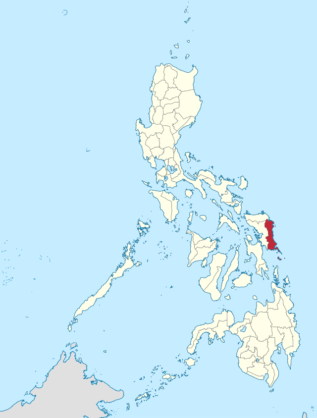
An Eastern Samar sarong provincia kan Republika kan Filipinas sa rehiyon Subangan na Visayas sa Visayas. Sosog sa sensus kan 1 Mayo 2020, igwa ining 477,168 katawong nag-eerok digdi sa 105,653 kaharongan. Igwa ining sukol na 4,660.47 kilometro kwadrado. An designadong area code kaini iyo +63 (0)55.
Eastern Samar | |||
|---|---|---|---|
| |||
 Kinamumugtakan kan Eastern Samar | |||
 | |||
| Tagboan: | |||
| Nasyon | Filipinas | ||
| Pigtugdas | Hunyo 19, 1965 | ||
| Kapitolyo | Borongan | ||
| Barangay | 597 | ||
| Pamamahala | |||
| • Gobernador nin Eastern Samar | Ben Evardone | ||
| • Electorado | 338,718 votantes (9 Mayo 2019) | ||
| Hiwas | |||
| • Kabuuhan | 4,660.47 km2 (1,799.42 sq mi) | ||
| Elebasyon | 16 m (52 ft) | ||
| Populasyon (Mayo 1, 2020)[1] | |||
| • kabuuhan | 477,168 | ||
| • Densidad | 100/km2 (270/sq mi) | ||
| • Saro | 105,653 | ||
| Economia | |||
| • Klase | ikaduwang klaseng probinsya | ||
| • Ingresos | ₱1,458,546,807.39 (2020) | ||
| • Activos | ₱4,782,671,764.70 (2020) | ||
| • Pasivos | ₱1,448,225,523.30 (2020) | ||
| • Gastos | ₱1,178,039,085.89 (2020) | ||
| Kodigo nin postal | 6800–6822 | ||
| PSGC | 082600000 | ||
| Kodigo telefonico | 55 | ||
| Tataramon | Waray-Waray | ||
| Websityo | www | ||

| Taon | Tawo | ±% p.a. |
|---|---|---|
| 1903 | 79,645 | — |
| 1918 | 117,348 | +2.62% |
| 1939 | 154,347 | +1.31% |
| 1948 | 197,734 | +2.79% |
| 1960 | 237,747 | +1.55% |
| 1970 | 271,000 | +1.32% |
| 1975 | 287,149 | +1.17% |
| 1980 | 320,637 | +2.23% |
| 1990 | 329,335 | +0.27% |
| 1995 | 362,324 | +1.80% |
| 2000 | 375,822 | +0.79% |
| 2007 | 405,114 | +1.04% |
| 2010 | 428,877 | +2.10% |
| 2015 | 467,160 | +1.64% |
| 2020 | 477,168 | +0.42% |
| Toltolan: Philippine Statistics Authority[2][3][4][5] | ||
Seamless Wikipedia browsing. On steroids.
Every time you click a link to Wikipedia, Wiktionary or Wikiquote in your browser's search results, it will show the modern Wikiwand interface.
Wikiwand extension is a five stars, simple, with minimum permission required to keep your browsing private, safe and transparent.