From Wikipedia, the free encyclopedia
Koblenz is a Stod im Rheinlond. Sie is mid 115.268 Eihwohna de viatgräßte Stod im Bundeslond Rheinland-Pfalz. Sie liegt am „Deitschen Eck“, do wo d'Mosl in an Rhein fliassd und so a Landspitzn buidt wead.[2]
| Der Artikl is im Dialekt Obaboarisch gschriem worn. |
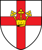
| Woppn | Deitschlandkoatn | |
|---|---|---|
 |
| |
| Basisdotn | ||
| Bundesland: | Rheinland-Pfalz | |
| Hechn: | 73 m ü. NHN | |
| Flächn: | 105,13 km2 | |
| Eihwohna: | 113.844 (31. Dez. 2017)[1] | |
| Bevökarungsdichtn: | 1083 Einwohner je km2 | |
| Postleitzoien: | 56001–56077 | |
| Voawoien: | 0261, 02606 (Lay) | |
| Autokennzeichn: | KO | |
| Gmoaschlissl: | 07 1 11 000 | |
| LOCODE: | DE KOB | |
| Stodgliedarung: | 30 Stodtei, darunta 8 Ortsbezirke | |
| Address vo da Stodvawoitung: |
Willi-Hörter-Platz 1 56068 Koblenz | |
| Webseitn: | ||
| Obabuagamoasta: | Joachim Hofmann-Göttig (SPD) | |
| Log vo Koblenz in Rheinland-Pfalz | ||
 | ||


De Stod hod im Joar 1992 ihr zwoatausndjaarigs Jubiläum gfeiert und güt dmid ois oane vo de ödastn Städt in Deitschland. A boa Grätzln ghernt zum WödKuituaeabe.
Da Naum leit si vom lateinischn Confluentes („Zaumrina“) ob.
Seamless Wikipedia browsing. On steroids.
Every time you click a link to Wikipedia, Wiktionary or Wikiquote in your browser's search results, it will show the modern Wikiwand interface.
Wikiwand extension is a five stars, simple, with minimum permission required to keep your browsing private, safe and transparent.