File:Norwegian_Sea_map_no.png
From Wikipedia, the free encyclopedia
Size of this preview: 657 × 600 pixels. Other resolutions: 263 × 240 pixels | 526 × 480 pixels | 1,000 × 913 pixels.
Original file (1,000 × 913 pixels, file size: 406 KB, MIME type: image/png)
| This is a file from the Wikimedia Commons. Information from its description page there is shown below. Commons is a freely licensed media file repository. You can help. |
| DescriptionNorwegian Sea map no.png |
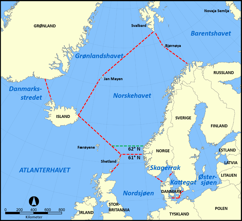
English: A map in Nowegian showing the location of the Norwegian Sea in the North Atlantic Ocean. Svenska: En karta över Norska havets läge i norra Atlanten. Norsk bokmål: Norsk kart over Norskehavets plassering i Nord-Atlanterhavet. |
| Date | |
| Source | Own work |
| Author | Gryphonis |
| Other versions |
[edit]
|


I, the copyright holder of this work, hereby publish it under the following licenses:
| This file is licensed under the Creative Commons Attribution-Share Alike 3.0 Unported license. | ||
| ||
| This licensing tag was added to this file as part of the GFDL licensing update.http://creativecommons.org/licenses/by-sa/3.0/CC BY-SA 3.0Creative Commons Attribution-Share Alike 3.0truetrue |

|
Permission is granted to copy, distribute and/or modify this document under the terms of the GNU Free Documentation License, Version 1.2 or any later version published by the Free Software Foundation; with no Invariant Sections, no Front-Cover Texts, and no Back-Cover Texts. A copy of the license is included in the section entitled GNU Free Documentation License.http://www.gnu.org/copyleft/fdl.htmlGFDLGNU Free Documentation Licensetruetrue |
| This file is licensed under the Creative Commons Attribution-Share Alike 3.0 Unported license. | ||
| ||
| This licensing tag was added to this file as part of the GFDL licensing update.http://creativecommons.org/licenses/by-sa/3.0/CC BY-SA 3.0Creative Commons Attribution-Share Alike 3.0truetrue |
You may select the license of your choice.
Original upload log
This image is a derivative work of the following images:
- File:Norwegian_Sea_map.png licensed with Cc-by-sa-3.0-migrated, GFDL
- 2005-11-07T16:10:45Z NormanEinstein 1000x913 (525159 Bytes)
Captions
Add a one-line explanation of what this file represents
Items portrayed in this file
depicts
2 October 2012
File history
Click on a date/time to view the file as it appeared at that time.
| Date/Time | Thumbnail | Dimensions | User | Comment | |
|---|---|---|---|---|---|
| current | 12:19, 2 October 2012 | | 1,000 × 913 (406 KB) | Gryphonis | update of limits |
| 01:22, 15 September 2012 |  | 1,000 × 913 (398 KB) | Gryphonis | {{Information |Description ={{en|1={{Information |Description={{en|A map in Nowegian showing the location of the Norwegian Sea in the North Atlantic Ocean.}} {{sv|En svensk karta över Norska havets läge i norra Atlanten.}} {{no|Norsk kart over Nor... |
File usage
No pages on the English Wikipedia use this file (pages on other projects are not listed).
Global file usage
The following other wikis use this file:
- Usage on de.wikipedia.org
- Usage on fo.wikipedia.org
- Usage on nn.wikipedia.org
- Usage on no.wikipedia.org
- Usage on uk.wikipedia.org
Metadata
This file contains additional information, probably added from the digital camera or scanner used to create or digitize it.
If the file has been modified from its original state, some details may not fully reflect the modified file.
| Horizontal resolution | 35.43 dpc |
|---|---|
| Vertical resolution | 35.43 dpc |
Retrieved from "https://en.wikipedia.org/wiki/File:Norwegian_Sea_map_no.png"