
Geisa
Town in Thuringia, Germany / From Wikipedia, the free encyclopedia
Dear Wikiwand AI, let's keep it short by simply answering these key questions:
Can you list the top facts and stats about Geisa?
Summarize this article for a 10 year old
SHOW ALL QUESTIONS
Geisa (German pronunciation: [ˈɡaɪ̯za] ⓘ) is a town in the Wartburgkreis district, in Thuringia, Germany. It is situated in the Rhön Mountains, 26 km northeast of Fulda. The near border with Hesse was the border between West Germany and the GDR during the Cold War. Thus, Geisa was in the East German border restriction area of the former inner German border, which meant that until reunification access to the town was limited. The town is the westernmost municipality in what was formerly East Germany.
Quick Facts Country, State ...
Geisa | |
|---|---|
 | |
 Coat of arms | |
Location of Geisa within Wartburgkreis district 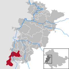 | |
 Geisa  Geisa | |
| Coordinates: 50°43′N 09°58′E | |
| Country | Germany |
| State | Thuringia |
| District | Wartburgkreis |
| Government | |
| • Mayor (2020–26) | Manuela Henkel[1] |
| Area | |
| • Total | 71.75 km2 (27.70 sq mi) |
| Elevation | 318 m (1,043 ft) |
| Population (2022-12-31)[2] | |
| • Total | 4,823 |
| • Density | 67/km2 (170/sq mi) |
| Time zone | UTC+01:00 (CET) |
| • Summer (DST) | UTC+02:00 (CEST) |
| Postal codes | 36419 |
| Dialling codes | 036967 |
| Vehicle registration | WAK |
| Website | www.geisa.de |
Close