Top Qs
Timeline
Chat
Perspective
Chetwode Islands
Island group in New Zealand From Wikipedia, the free encyclopedia
Remove ads
The Chetwode Islands are a group of islands near the Marlborough Sounds along the northern coast of the South Island of New Zealand.


This article needs additional citations for verification. (May 2020) |
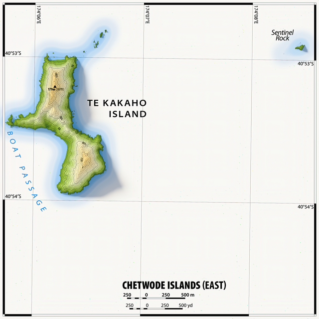
The group consists of Nukuwaiata Island (to the southwest), rising to 247 m (810 ft), and Te Kakaho Island (highest elevation 179 m (587 ft)) to the northeast. The remaining islets are tiny in comparison. All 324 ha (800 acres) of the Chetwode Islands are a nature reserve.[1]
The islands are named after Lieutenant Chetwode, acting commander of the Cruizer-class brig-sloop, HMS Pelorus in 1838.
Remove ads
See also
References
External links
Wikiwand - on
Seamless Wikipedia browsing. On steroids.
Remove ads


