File:Netherlands_map_large_dutch-10-10-10.png
維基百科,自由的 encyclopedia
本预览的尺寸:506 × 600像素。 其他分辨率:202 × 240像素 | 405 × 480像素。
原始文件 (800 × 948像素,文件大小:246 KB,MIME类型:image/png)

|
File:Map provinces Netherlands-nl.svg是此文件的矢量版本。 应当将此点阵图片替换为该文件。
File:Netherlands map large dutch-10-10-10.png → File:Map provinces Netherlands-nl.svg
更多信息请参阅Help:SVG/zh。
|
 |
摘要
Map of the Netherlands in Dutch with BES Islands
Based on Image:Netherlands map large dutch 3.png
摘要
Map of the Netherlands in Dutch.
Based on Image:Netherlands map large.png
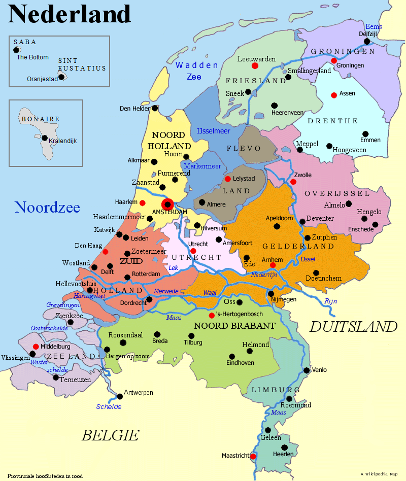
| 描述Netherlands map large dutch-10-10-10.png | The red dots are the capitals of the provinces. The capital of the Netherlands, Amsterdam, has a red/black dot. The rest are the bigger cities. |
| 来源 | from en-wiki |
| 作者 | Scipius |

|
已授权您依据自由软件基金会发行的无固定段落及封面封底文字(Invariant Sections, Front-Cover Texts, and Back-Cover Texts)的GNU自由文件许可协议1.2版或任意后续版本的条款,复制、传播和/或修改本文件。该协议的副本请见“GNU Free Documentation License”。http://www.gnu.org/copyleft/fdl.htmlGFDLGNU Free Documentation Licensetruetrue |
| 本文件采用知识共享署名-相同方式共享 3.0 未本地化版本许可协议授权。 | ||
| ||
| 本许可协议标签作为GFDL许可协议更新的组成部分被添加至本文件。http://creativecommons.org/licenses/by-sa/3.0/CC BY-SA 3.0Creative Commons Attribution-Share Alike 3.0truetrue |
说明
添加一行文字以描述该文件所表现的内容
此文件中描述的项目
描繪內容
文件历史
点击某个日期/时间查看对应时刻的文件。
| 日期/时间 | 缩略图 | 大小 | 用户 | 备注 | |
|---|---|---|---|---|---|
| 当前 | 2010年12月6日 (一) 08:46 | | 800 × 948(246 KB) | LennartBolks~commonswiki | {{Information |Description={{en|1=X}} |Source=X |Author=X |Date=X |Permission= |other_versions= }} Category:Provinces of the Netherlands Category:Maps of the Netherlands |
文件用途
没有页面链接到本图像。
全域文件用途
以下其他wiki使用此文件:
- de.wikipedia.org上的用途