File:Io-Torishima_gsi-20081121.jpg
維基百科,自由的 encyclopedia
本预览的尺寸:600 × 600像素。 其他分辨率:240 × 240像素 | 480 × 480像素 | 768 × 768像素 | 1,024 × 1,024像素 | 2,048 × 2,048像素 | 3,000 × 3,000像素。
原始文件 (3,000 × 3,000像素,文件大小:984 KB,MIME类型:image/jpeg)
摘要
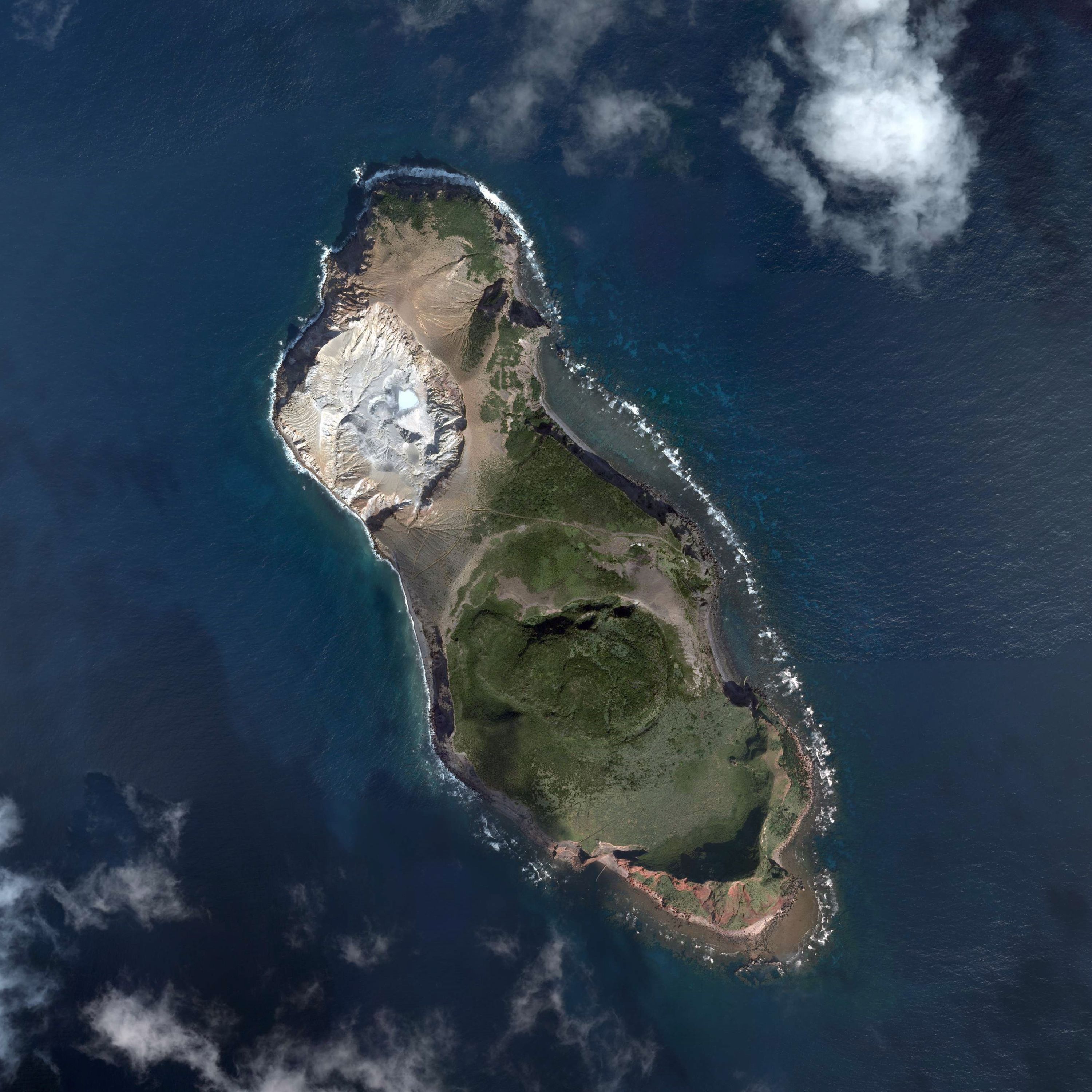
| 描述Io-Torishima gsi-20081121.jpg |
English: Io-Torishima, Kumejima, Okinawa, Japan.
日本語:硫黄鳥島
国土交通省の地図・空中写真閲覧サービスを元に作成。6枚の空中写真を合成。
|
| 日期 | |
| 来源 | C1-1, C1-2, C1-3, C1-4, C1-5, C1-6 |
| 作者 |
English: Geospatial Information Authority of Japan
日本語:国土地理院 |
许可协议

|
本文件的著作权人,Ministry of Land, Infrastructure, Transport and Tourism,允许任何人在适当地表明著作权人的姓名的前提下,以任何目的使用本文件。传播,演绎作品,商业用途及所有其他用途被允许。 |
署名:
National Land Image Information (Color Aerial Photographs), created by Ministry of Land, Infrastructure, Transport and Tourism, distributed by Geospatial Information Authority of Japan Attribution |

|
When you use this image on an article, please include the following phrase or equivalent for attribution and citation: "National Land Image Information (Color Aerial Photographs), created by Ministry of Land, Infrastructure, Transport and Tourism, distributed by Geospatial Information Authority of Japan." |
说明
添加一行文字以描述该文件所表现的内容
此文件中描述的项目
描繪內容
僅需姓名標示授權條款 Chinese (Taiwan)(已转写)
21 11 2008
文件历史
点击某个日期/时间查看对应时刻的文件。
| 日期/时间 | 缩略图 | 大小 | 用户 | 备注 | |
|---|---|---|---|---|---|
| 当前 | 2015年10月16日 (五) 10:04 | | 3,000 × 3,000(984 KB) | Kugel~commonswiki | =={{int:filedesc}}== {{Information |description={{en|1=Io-Torishima, Kumejima, Okinawa, Japan.}} {{ja|1=硫黄鳥島 国土交通省の地図・空中写真閲覧サービスを元に作成。6枚の空中写真を合成。 *整理番号 CKU20088X *�... |
文件用途
以下页面使用本文件:
全域文件用途
以下其他wiki使用此文件:
- ja.wikipedia.org上的用途
- ko.wikipedia.org上的用途
- www.wikidata.org上的用途
- zh-min-nan.wikipedia.org上的用途