File:New_South_Wales_locator-MJC.png
維基百科,自由的 encyclopedia
此为最大尺寸。
New_South_Wales_locator-MJC.png (563 × 476像素,文件大小:12 KB,MIME类型:image/png)

|
此locator map图片可使用矢量图形重新创建为SVG文件。这具有很多好处;更多信息请参见共享资源:待清理媒体。如果存在此图片的SVG格式,请将其上传,然后将此模板替换为
{{vector version available|新图片名称}}。
建议您将SVG命名为“New South Wales locator-MJC.svg”,这样在使用Vector version available(或Vva)模板时就不需要填写新图片名称参数。 |
摘要
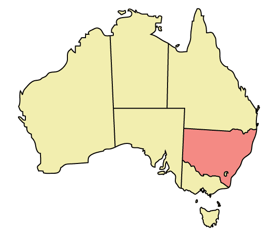
Map of Australia highlighting New South Wales
Made in Adobe Illustrator by Martynam and released under the GFDL
许可协议
| 本文件采用知识共享署名-相同方式共享 3.0 未本地化版本许可协议授权。 受免責聲明的約束。 | ||
| ||
| 本许可协议标签作为GFDL许可协议更新的组成部分被添加至本文件。http://creativecommons.org/licenses/by-sa/3.0/CC BY-SA 3.0Creative Commons Attribution-Share Alike 3.0truetrue |

|
已授权您依据自由软件基金会发行的无固定段落及封面封底文字(Invariant Sections, Front-Cover Texts, and Back-Cover Texts)的GNU自由文件许可协议1.2版或任意后续版本的条款,复制、传播和/或修改本文件。该协议的副本请见“GNU Free Documentation License”。 受免責聲明的約束。http://www.gnu.org/copyleft/fdl.htmlGFDLGNU Free Documentation Licensetruetrue |
说明
添加一行文字以描述该文件所表现的内容
此文件中描述的项目
描繪內容
文件历史
点击某个日期/时间查看对应时刻的文件。
| 日期/时间 | 缩略图 | 大小 | 用户 | 备注 | |
|---|---|---|---|---|---|
| 当前 | 2005年12月30日 (五) 22:48 | | 563 × 476(12 KB) | Snowdog | Map of Australia highlighting New South Wales Made in Adobe Illustrator by Martynam and released under the GFDL Category:Maps of Australia |
文件用途
以下23个页面使用本文件:
- User:Ahuan
- User:Bbao
- User:Ericadolf
- User:Foreverj2222
- User:Litianao
- User:Lucy melbourne/沙盒/JP3
- User:MatsurinK
- User:Not in severs area
- User:Pixy132
- User:Quest for Truth
- User:Shinghinyeung/UBX
- User:Viviene
- User:Wpliao~zhwiki
- User:哲婶子666
- User:方冰龍
- Wikipedia:用户框/地域/大洋洲
- Wikipedia:用户框/地域/澳洲
- Template:Infobox Australia state or territory
- Template:Infobox Australia state or territory/doc
- Template:Infobox Australia state or territory/sandbox
- Template:User New South Wales
- Template:User Sydney
- Template:User Sydney1
全域文件用途
以下其他wiki使用此文件:
- ar.wikipedia.org上的用途
- ckb.wikipedia.org上的用途
- cs.wikipedia.org上的用途
- cy.wikipedia.org上的用途
- de.wikipedia.org上的用途
- en.wikipedia.org上的用途
- User:99of9
- User:Stixpjr
- User:Nomadtales
- East Richmond railway station, Sydney
- Penshurst railway station, Sydney
- Punchbowl railway station
- Narrandera Airport
- User:SamJohnston
- User:Martyman/My Images/Maps
- Glenreagh Mountain Railway
- User:Grogan deYobbo
- RAAF Base Glenbrook
- Dochra Airfield
- Allandale railway station, New South Wales
- Cemetery Station No. 3 railway station
- Cemetery Station No. 2 railway station
- Rookwood railway station, Sydney
- Ballina Byron Gateway Airport
- User:RuthlessOne
- Palm Beach Water Airport
- Broken Hill railway line
- Stroud Road railway station
- Transport Construction Authority
- Lismore Airport
- Broken Hill Airport
- Coonamble Airport
- Griffith Airport
- Lightning Ridge Airport
- Bourke Airport
- Cobar Airport
- Walgett Airport
- Merimbula Airport
- Narrabri Airport
- Parkes Airport
- West Wyalong Airport
- Clyburn railway station
- Delec Platform railway station
- Hope Street Platform railway station
- Enfield South Platform railway station
- Cochrane railway station, Sydney
- Oaklands railway line, New South Wales
- Hay railway line
- Rankins Springs railway line
- Burcher railway line
- Tocumwal railway line, New South Wales
查看此文件的更多全域用途。