File:Colonisation_1885.png
From Wikipedia, the free encyclopedia
原本檔案 (1,200 × 526 像素,檔案大細:206 KB ,MIME類型:image/png)
| References for this description (or part of this) or for the depiction in the file are not provided. |
| 描述Colonisation 1885.png |
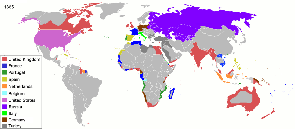
Map of major world powers by year, derived from public domain animated map on wikipedia.
As the orriginal licence of the animation was Public Domain, this image which has been derived from it is too:
|
|||||||||||||||||||
| 日期 | ||||||||||||||||||||
| 來源 | public domain animated map by ArdadN here | |||||||||||||||||||
| 作者 | ArdadN | |||||||||||||||||||
.jpg)
._LOC_2001620596.jpg)

|
This historical map image could be recreated using vector graphics as an SVG file. This has several advantages; see Commons:Media for cleanup for more information. If an SVG form of this image is already available, please upload it. After uploading an SVG, replace this template with {{vector version available|new image name.svg}}.
|
Captions
22 3 2007
image/png
210,626 字節
526 像素
1,200 像素
檔案歷史
撳個日期/時間去睇響嗰個時間出現過嘅檔案。
| 日期/時間 | 縮圖 | 尺寸 | 用戶 | 註解 | |
|---|---|---|---|---|---|
| 現時 | 2021年11月8號 (一) 09:05 | | 1,200 × 526(206 KB) | Randomastwritter | jubaland |
| 2020年4月5號 (日) 09:52 |  | 1,200 × 526(206 KB) | Ориенталист | South Sakhalin was part of Russia in 1885 | |
| 2015年5月2號 (六) 11:17 |  | 1,425 × 625(49 KB) | Chrischerf | German Empire and colonies in 1885; Sudan under control of the Mahdi | |
| 2014年8月3號 (日) 02:57 |  | 1,425 × 625(54 KB) | Alvin Lee | correcting the boundaries of Russia and China | |
| 2013年11月3號 (日) 13:54 |  | 1,425 × 625(78 KB) | McZusatz | Reverted to version as of 00:22, 24 January 2011 [corrupt file?] | |
| 2012年11月3號 (六) 15:24 |  | 1,425 × 625(67 KB) | Franco310397 | Spanish presence in Micronesia (Oceania) included in the Captaincy General of the Philippines. In the Caroline Islands and the Mariana Islands. | |
| 2011年1月24號 (一) 00:22 |  | 1,425 × 625(78 KB) | Micsha~commonswiki | Reverted to version as of 02:17, 3 May 2010 | |
| 2011年1月24號 (一) 00:22 |  | 506 × 326(85 KB) | Micsha~commonswiki | Only Africa; includes map key | |
| 2010年5月3號 (一) 02:17 |  | 1,425 × 625(78 KB) | Kieran4 | slight edit | |
| 2010年5月3號 (一) 02:14 |  | 1,425 × 625(78 KB) | Kieran4 | Correct Dutch East INdies |
檔案用途
無嘢連來呢份檔案。
全域檔案使用情況
下面嘅維基都用緊呢個檔案:
- am.wikipedia.org嘅使用情況
- de.wikipedia.org嘅使用情況
- en.wikipedia.org嘅使用情況
- es.wikipedia.org嘅使用情況
- fr.wikipedia.org嘅使用情況
- he.wikipedia.org嘅使用情況
- oc.wikipedia.org嘅使用情況
- sk.wikipedia.org嘅使用情況
Metadata
呢個檔案有額外嘅資料。佢應該係數碼相機或者掃描器整出來嘅。如果佢整咗之後畀人改過,裏面嘅資料未必同改過之後相符。
| 橫解像度 | 47.24 dpc |
|---|---|
| 直解像度 | 47.24 dpc |
| PNG文件註 | |
| 用過嘅軟件 |
|