File:Amerikanska-medelhavet.png
From Wikipedia, the free encyclopedia
原本檔案 (2,410 × 2,045 像素,檔案大細:4.57 MB ,MIME類型:image/png)
| 描述Amerikanska-medelhavet.png | Amerikanska medelhavet |
| 日期 | (UTC) |
| 來源 | |
| 作者 |
|
| This is a retouched picture, which means that it has been digitally altered from its original version. The original can be viewed here: Topographic30deg N0W60.png:
|
| Public domainPublic domainfalsefalse |
This image is in the public domain because it came from the site https://www.demis.nl/products/web-map-server/examples/ and was released by the copyright holder. Permission is granted to copy, distribute and/or modify this map since it is based on free of copyright images from: www.demis.nl. See also approval email on de.wp and its clarification.
Deutsch | English | македонски | മലയാളം | Nederlands | slovenščina | +/− |
| Public domainPublic domainfalsefalse |
| This work has been released into the public domain by its copyright holder, www.demis.nl. This applies worldwide. In some countries this may not be legally possible; if so: www.demis.nl grants anyone the right to use this work for any purpose, without any conditions, unless such conditions are required by law. Public domainPublic domainfalsefalse |
Original upload log
This image is a derivative work of the following images:
- File:Topographic30deg_N0W60.png licensed with PD-Demis
- 2005-05-26T17:28:09Z Koba-chan 1800x1800 (926487 Bytes) ---- Map created from [http://www2.demis.nl/mapserver/mapper.asp DEMIS Mapserver], which are public domain. [[User:Koba-chan|Koba-chan]] {{GFDL}} [[Category:Topographic maps]] [[Category:Earth]]
Uploaded with derivativeFX
Captions
Add a one-line explanation of what this file represents
Items portrayed in this file
圖中顯示嘅係
19 8 2011
image/png
4,796,376 字節
2,045 像素
2,410 像素
檔案歷史
撳個日期/時間去睇響嗰個時間出現過嘅檔案。
| 日期/時間 | 縮圖 | 尺寸 | 用戶 | 註解 | |
|---|---|---|---|---|---|
| 現時 | 2011年8月19號 (五) 05:02 | 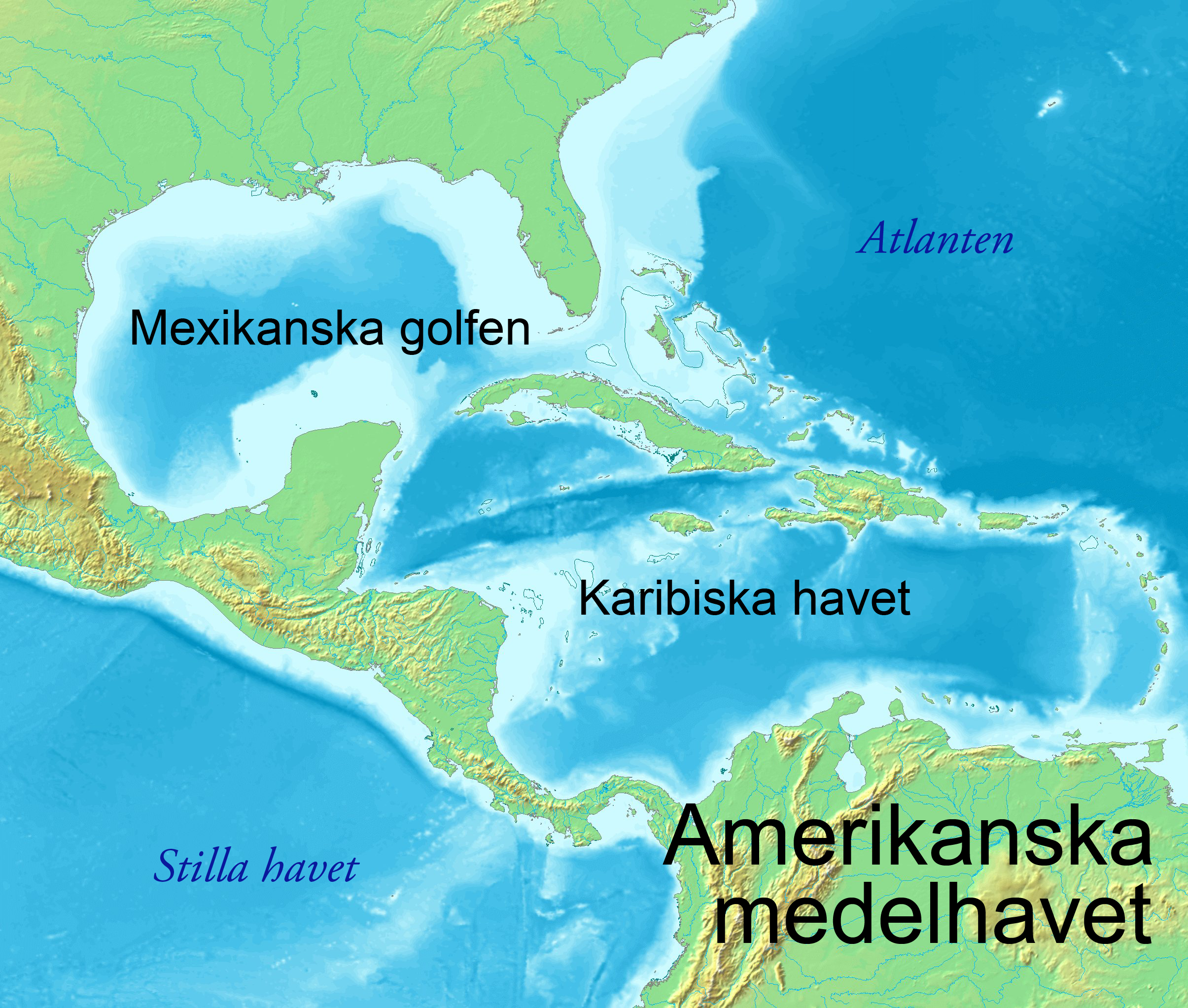 | 2,410 × 2,045(4.57 MB) | Ysjyd | {{Information |Description=== Amerikanska medelhavet |Source=*File:Topographic30deg_N0W60.png |Date=2011-08-19 04:50 (UTC) |Author=*File:Topographic30deg_N0W60.png: PD-Demis *derivative work: Ysjyd |Permission= |other_versions= }} {{Retouched |
檔案用途
無嘢連來呢份檔案。
全域檔案使用情況
下面嘅維基都用緊呢個檔案:
- sv.wikipedia.org嘅使用情況