福斯灣

来自维基百科,自由的百科全书

福斯湾map

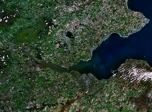
福斯灣(英語:Firth of Forth蘇格蘭蓋爾語:Linne Foirthe)位於英國蘇格蘭東部,在福斯河的入海口(北海)。灣長77公里,最寬處28公里。有福斯公路福斯鐵路橋跨灣。愛丁堡為沿岸城市。2001年,福斯灣被列入濕地公約

Thumb
福斯灣周圍地區的衛星圖
Quick Facts Firth of Forth 福斯灣, 位置 ...
Firth of Forth
福斯灣
Thumb
橫跨福斯灣的福斯橋
Thumb
Firth of Forth 福斯灣
Firth of Forth
福斯灣
Firth of Forth
福斯灣在蘇格蘭的位置
Thumb
Firth of Forth 福斯灣
Firth of Forth
福斯灣
Firth of Forth
福斯灣 (法夫)
Thumb
Firth of Forth 福斯灣
Firth of Forth
福斯灣
Firth of Forth
福斯灣 (福爾柯克)
Thumb
Firth of Forth 福斯灣
Firth of Forth
福斯灣
Firth of Forth
福斯灣 (克拉克曼南郡)
位置 英國蘇格蘭
座標56.075°N 3.750°W / 56.075; -3.750
所在國家 英國
 蘇格蘭
評定時間2001年10月30日
參考編碼1111[1]
Close

參考文獻

Wikiwand in your browser!

Seamless Wikipedia browsing. On steroids.

Every time you click a link to Wikipedia, Wiktionary or Wikiquote in your browser's search results, it will show the modern Wikiwand interface.

Wikiwand extension is a five stars, simple, with minimum permission required to keep your browsing private, safe and transparent.