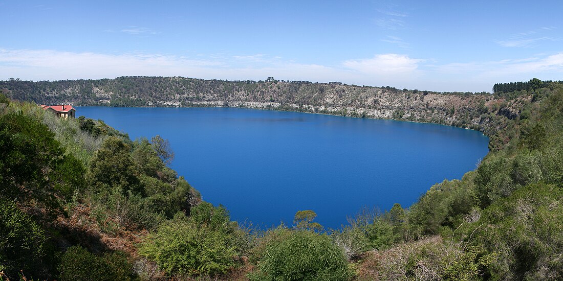
甘比爾山
南澳大利亞的小鎮 来自维基百科,自由的百科全书
甘比爾山(英語:Mount Gambier)位於澳洲南澳州首府阿得雷德以南450公里,墨爾本以西435公里處,是南澳州繼阿得雷德之後的第二大城市。2006年人口為23,494。
氣候
據柯本氣候分類法,甘比爾山屬地中海式氣候(Csb),夏季乾燥溫暖,冬季清涼潮濕。7月是全年最濕的月份,平均降雨量為100.2 mm,2月降雨量最少,平均只有26 mm。有記錄以來錄得最高溫度為44.9 °C(2014年2月2日)[5],最低溫度為−3.9 °C(1950年6月20日和1960年7月2日)[6]。
| 甘比爾山 (63 m AMSL) | |||||||||||||
|---|---|---|---|---|---|---|---|---|---|---|---|---|---|
| 月份 | 1月 | 2月 | 3月 | 4月 | 5月 | 6月 | 7月 | 8月 | 9月 | 10月 | 11月 | 12月 | 全年 |
| 歷史最高溫 °C(°F) | 44.1 (111.4) |
44.9 (112.8) |
41.3 (106.3) |
35.8 (96.4) |
28.5 (83.3) |
21.6 (70.9) |
22.4 (72.3) |
26.6 (79.9) |
32.2 (90.0) |
33.3 (91.9) |
41.2 (106.2) |
43.3 (109.9) |
44.9 (112.8) |
| 平均高溫 °C(°F) | 25.3 (77.5) |
25.3 (77.5) |
23.1 (73.6) |
19.5 (67.1) |
16.1 (61.0) |
13.9 (57.0) |
13.2 (55.8) |
14.2 (57.6) |
15.9 (60.6) |
18.0 (64.4) |
20.5 (68.9) |
23.0 (73.4) |
19.0 (66.2) |
| 平均低溫 °C(°F) | 11.2 (52.2) |
11.7 (53.1) |
10.6 (51.1) |
8.8 (47.8) |
7.4 (45.3) |
5.8 (42.4) |
5.2 (41.4) |
5.5 (41.9) |
6.3 (43.3) |
7.1 (44.8) |
8.4 (47.1) |
10.0 (50.0) |
8.2 (46.8) |
| 歷史最低溫 °C(°F) | 1.4 (34.5) |
2.8 (37.0) |
0.0 (32.0) |
−1.8 (28.8) |
−2.8 (27.0) |
−3.9 (25.0) |
−3.9 (25.0) |
−2.6 (27.3) |
−3.4 (25.9) |
−1.6 (29.1) |
−0.8 (30.6) |
1.2 (34.2) |
−3.9 (25.0) |
| 平均降水量 mm(英寸) | 27.4 (1.08) |
26.0 (1.02) |
35.8 (1.41) |
54.7 (2.15) |
71.8 (2.83) |
84.1 (3.31) |
100.2 (3.94) |
95.7 (3.77) |
72.6 (2.86) |
60.7 (2.39) |
46.2 (1.82) |
38.3 (1.51) |
711.1 (28.00) |
| 平均降水天數 | 8.4 | 7.8 | 11.0 | 14.5 | 18.4 | 19.8 | 21.9 | 21.6 | 19.1 | 16.8 | 13.2 | 11.6 | 184.1 |
| 平均相對濕度(%) | 44 | 44 | 49 | 56 | 68 | 73 | 72 | 67 | 63 | 59 | 53 | 48 | 58 |
| 月均日照時數 | 282.1 | 243.6 | 213.9 | 165.0 | 136.4 | 120.0 | 133.3 | 164.3 | 171.0 | 213.9 | 228.0 | 251.1 | 2,322.6 |
| 資料來源:[7] | |||||||||||||
參考資料
Wikiwand - on
Seamless Wikipedia browsing. On steroids.


