File:IranYazd.png
維基百科,自由的 encyclopedia
預覽大小:648 × 599 像素。 其他解析度:260 × 240 像素 | 519 × 480 像素 | 879 × 813 像素。
原始檔案 (879 × 813 像素,檔案大小:25 KB,MIME 類型:image/png)
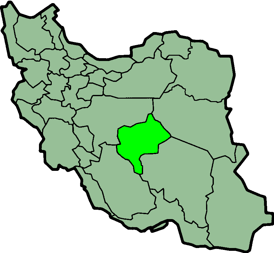
Province of Yazd, Iran

|
這個檔案已經被IranYazd-SVG.svg取代。 建議您使用其他圖像。請注意要刪除被取代的圖像的話,您需要首先取得社群共識。
|

|
Taken from en:Image:IranYazd.png
Created by en:User:Morwen

|
已授權您依據自由軟體基金會發行的無固定段落、封面文字和封底文字GNU自由文件授權條款1.2版或任意後續版本,對本檔進行複製、傳播和/或修改。該協議的副本列在GNU自由文件授權條款中。http://www.gnu.org/copyleft/fdl.htmlGFDLGNU Free Documentation Licensetruetrue |
| 此檔案採用創用CC 姓名標示-相同方式分享 3.0 未在地化版本授權條款。 | ||
| ||
| 已新增授權條款標題至此檔案,作為GFDL授權更新的一部份。http://creativecommons.org/licenses/by-sa/3.0/CC BY-SA 3.0Creative Commons Attribution-Share Alike 3.0truetrue |
說明
添加單行說明來描述出檔案所代表的內容
在此檔案描寫的項目
描繪內容
檔案歷史
點選日期/時間以檢視該時間的檔案版本。
| 日期/時間 | 縮圖 | 尺寸 | 使用者 | 備註 | |
|---|---|---|---|---|---|
| 目前 | 2013年6月24日 (一) 00:20 | | 879 × 813(25 KB) | BasilLeaf | بروزرسانی مرز بین استانهای یزد و خراسان جنوبی، تهران و البرز، فارس و یزد و اصفهان |
| 2010年11月12日 (五) 12:07 |  | 879 × 813(41 KB) | M samadi | Quality improved, Border of some provinces updated. | |
| 2010年10月13日 (三) 13:13 |  | 200 × 185(16 KB) | Amin19850 | Tehran & Alborz Province is divided | |
| 2006年11月8日 (三) 21:59 |  | 200 × 185(14 KB) | Raymond | transparent background, improved color palette | |
| 2005年12月17日 (六) 05:30 |  | 200 × 185(19 KB) | Kotoito | Yazd Province, Iran, taken from de:Bild:Lage der Provinz Yazd im Iran.png, created by de:Benutzer:Henrik Motakef | |
| 2005年9月17日 (六) 10:41 |  | 200 × 185(20 KB) | Dodo | Province of Yazd, Iran Taken from en:Image:IranYazd.png Created by en:User:Morwen {{GFDL}} Category:Maps of Iran |
檔案用途
下列頁面有用到此檔案:
全域檔案使用狀況
以下其他 wiki 使用了這個檔案:
- ar.wikipedia.org 的使用狀況
- bn.wikipedia.org 的使用狀況
- ca.wikipedia.org 的使用狀況
- ckb.wikipedia.org 的使用狀況
- da.wikipedia.org 的使用狀況
- el.wikipedia.org 的使用狀況
- en.wikipedia.org 的使用狀況
- Chak Chak, Yazd
- Shir Kuh
- Allahabad, Yazd
- Abarkuh County
- Bafq County
- Khatam County
- Ashkezar County
- Meybod
- Zarach, Iran
- Baz, Iran
- Manshad
- Shahid Sadooghi Airport
- Template:Yazd-geo-stub
- Majumard
- User:AlexNebraska/Images of Iran
- Behabad County
- Central District (Ardakan County)
- Ahmadabad, Iran
- Kharanaq District
- Aqda District
- Aqda
- Bafq
- Central District (Bafq County)
- Behabad
- Taft, Iran
- Central District (Taft County)
- Nir, Yazd
- Nir District
- Mehriz
- Central District (Mehriz County)
- Central District (Yazd County)
- Shahediyeh
- Hamidiya
- Zarach District
- Central District (Meybod County)
- Central District (Abarkuh County)
- Mehrdasht
- Bahman District
- Khezrabad
- Khezrabad District
- Nadushan
- Ashkezar
- Central District (Ashkezar County)
檢視此檔案的更多全域使用狀況。
詮釋資料
此檔案中包含其他資訊,這些資訊可能是由數位相機或掃描器在建立或數位化過程中所新增的。若檔案自原始狀態已被修改,一些詳細資料可能無法完整反映出已修改的檔案。
| 水平解析度 | 37.79 dpc |
|---|---|
| 垂直解析度 | 37.79 dpc |