File:Bavi_2020_landfall.gif
維基百科,自由的 encyclopedia
預覽大小:800 × 582 像素。 其他解析度:320 × 233 像素 | 640 × 466 像素 | 1,050 × 764 像素。
原始檔案 (1,050 × 764 像素,檔案大小:8.37 MB,MIME 類型:image/gif、循環、30 畫格、4.8秒)
摘要
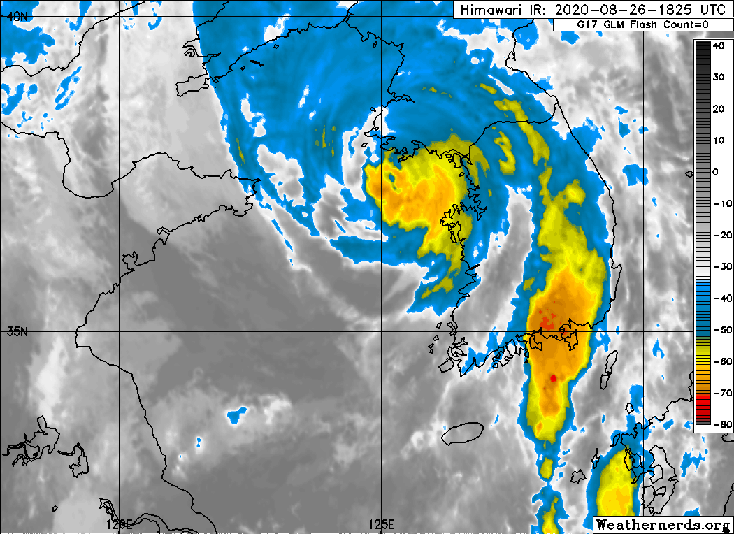
| 描述Bavi 2020 landfall.gif |
English: AVN imagery of Typhoon Bavi making landfall on North Korea on August 26, 2020 |
| 日期 | |
| 來源 | https://www.weathernerds.org/satellite/floaters/ |
| 作者 | Weathernerds.org |
| 授權許可 (重用此檔案) |
https://www.data.jma.go.jp/mscweb/en/general/note.html |
授權條款
This image was produced by the 日本氣象廳. The legal notice (archive) stated that all the images published on their website is compatible with the Creative Commons Attribution 4.0 License, which means that all the images on this website is published under the Creative Commons Attribution 4.0 License unless otherwise specified.
此檔案採用創用CC 姓名標示 4.0 國際授權條款。 姓名標示: 日本氣象廳
|
 |

說明
添加單行說明來描述出檔案所代表的內容
在此檔案描寫的項目
描繪內容
創用CC姓名標示4.0國際 繁體中文 (已轉換拼寫)
26 8 2020
image/gif
8,771,724 位元組
4.769999999999998 秒鐘
764 像素
1,050 像素
檔案歷史
點選日期/時間以檢視該時間的檔案版本。
| 日期/時間 | 縮圖 | 尺寸 | 使用者 | 備註 | |
|---|---|---|---|---|---|
| 目前 | 2020年8月27日 (四) 04:07 | | 1,050 × 764(8.37 MB) | Nino Marakot | Uploaded a work by Weathernerds.org from https://www.weathernerds.org/satellite/floaters/ with UploadWizard |
檔案用途
下列頁面有用到此檔案:
全域檔案使用狀況
以下其他 wiki 使用了這個檔案:
- en.wikipedia.org 的使用狀況