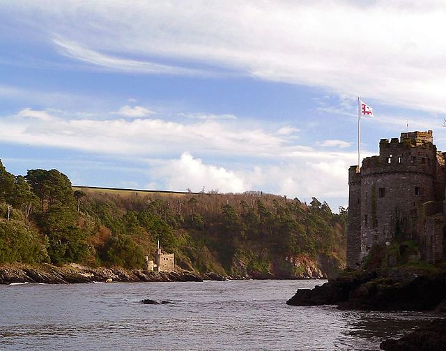
达特河
英国德文郡的河流 来自维基百科,自由的百科全书
达特河(英语:River Dart),是英国德文郡的一条河流,由达特穆尔流至达特茅斯,沿途流经山谷和田野,自然的景致令人目不暇给。河流的名称来自凯尔特语,意思为“有橡树生长的河流”[1]。达特河的上游分别为东达特河和西达特河,两者在达特米特汇合,最后流入英伦海峡。沿河建有多座克拉珀桥,当中最为知名的是位于达特穆尔已有数百年历史的古桥[2]。名为“Upper Dart”和“The Loop”的两段河道都是独木舟激流的热门胜地[3][4]。
| 达特河 River Dart | |
|---|---|
 达特河 | |
 | |
| 国家 | 英国 |
| 郡 | 德文郡 |
| 流域 | |
| 源头 | 西达特河 |
| • 位置 | Lower White Tor |
| • 海拔 | 450米(1,480英尺) |
| 第二源头 | 东达特河 |
| • 位置 | Kit Rock, Whinney's Down |
| • 海拔 | 510米(1,670英尺) |
| 河口 | 英伦海峡 |
| • 坐标 | 50°20′33″N 3°33′51″W |
| • 海拔 | 0米(0英尺) |
| 本貌 | |
| 流量 | |
| • 地点 | 巴克法斯特利奥斯汀之桥 |
| • 平均流量 | 11.04 m3/s(390 cu ft/s) |
| • 最大流量 | 40 m3/s(1,400 cu ft/s) |


图片集
-
达特河的鱼道
-
背景为托特尼斯桥
-
达特茅斯的观光船
-
独木舟激流
参考
外部链接
Wikiwand - on
Seamless Wikipedia browsing. On steroids.


