白玉县
中国四川省甘孜藏族自治州下辖的县 来自维基百科,自由的百科全书
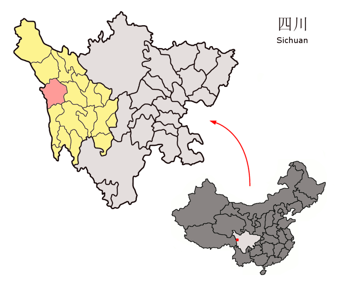
白玉县(藏语:དཔལ་ཡུལ་རྫོང,威利转写:dpal yul rdzong,藏语拼音:Baiyü Zong),位于中国四川省甘孜藏族自治州西部,人口约4.15万(2001年),辖17个乡镇。
行政区划
建设镇、阿察镇、河坡镇、盖玉镇、金沙乡、绒盖乡、章都乡、麻绒乡、热加乡、登龙乡、赠科乡、麻邛乡、辽西乡、纳塔乡、安孜乡和沙马乡。
山岩乡属三岩地区东侧,三岩是自古以来川藏交界著名的两不管地带,三岩地区西侧属西藏贡觉县。
地理
| 白玉(1981−2010) | |||||||||||||
|---|---|---|---|---|---|---|---|---|---|---|---|---|---|
| 月份 | 1月 | 2月 | 3月 | 4月 | 5月 | 6月 | 7月 | 8月 | 9月 | 10月 | 11月 | 12月 | 全年 |
| 平均高温 °C(°F) | 9.6 (49.3) |
11.8 (53.2) |
14.8 (58.6) |
17.8 (64.0) |
22.0 (71.6) |
24.1 (75.4) |
24.9 (76.8) |
24.2 (75.6) |
21.9 (71.4) |
18.5 (65.3) |
13.8 (56.8) |
9.8 (49.6) |
17.8 (64.0) |
| 日均气温 °C(°F) | −1.1 (30.0) |
1.9 (35.4) |
5.5 (41.9) |
8.7 (47.7) |
12.6 (54.7) |
15.2 (59.4) |
16.0 (60.8) |
15.2 (59.4) |
12.7 (54.9) |
8.4 (47.1) |
2.7 (36.9) |
−1.4 (29.5) |
8.0 (46.5) |
| 平均低温 °C(°F) | −9.2 (15.4) |
−6.2 (20.8) |
−2.1 (28.2) |
1.6 (34.9) |
5.4 (41.7) |
9.1 (48.4) |
10.4 (50.7) |
9.8 (49.6) |
7.4 (45.3) |
2.1 (35.8) |
−4.9 (23.2) |
−9.3 (15.3) |
1.2 (34.1) |
| 平均降水量 mm(吋) | 1.4 (0.06) |
2.9 (0.11) |
12.5 (0.49) |
31.6 (1.24) |
52.8 (2.08) |
118.5 (4.67) |
145.4 (5.72) |
124.9 (4.92) |
98.5 (3.88) |
33.1 (1.30) |
3.9 (0.15) |
1.3 (0.05) |
626.8 (24.67) |
| 平均相对湿度(%) | 33 | 34 | 41 | 49 | 53 | 65 | 71 | 72 | 74 | 64 | 47 | 39 | 54 |
| 数据来源:中国气象数据网[3] | |||||||||||||
参考文献
外部链接
Wikiwand - on
Seamless Wikipedia browsing. On steroids.

