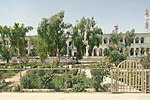
坎大哈
阿富汗第二大城市 来自维基百科,自由的百科全书
坎大哈(普什图语:قندهار,波斯语:قندهار),阿富汗第二大城市,位于该国南部,是阿富汗南部的经济、文化、交通中心,也是普什图族聚居的中心城市。

坎大哈建城于公元前4世纪,在很长的时间里都是波斯和印度诸王朝争夺的军事重镇。1747年,艾哈迈德·沙阿·杜兰尼在此称王,建立阿富汗王国,以坎大哈为首都。虽然阿富汗的首都很快便迁往喀布尔,但是坎大哈作为阿富汗南部地区中心的地位自此一直未被动摇。
气候
| 坎大哈 (1964–1983) | |||||||||||||
|---|---|---|---|---|---|---|---|---|---|---|---|---|---|
| 月份 | 1月 | 2月 | 3月 | 4月 | 5月 | 6月 | 7月 | 8月 | 9月 | 10月 | 11月 | 12月 | 全年 |
| 平均高温 °C(°F) | 12.2 (54.0) |
14.8 (58.6) |
21.6 (70.9) |
28.1 (82.6) |
34.1 (93.4) |
39.1 (102.4) |
40.2 (104.4) |
38.2 (100.8) |
34.0 (93.2) |
27.5 (81.5) |
21.0 (69.8) |
15.4 (59.7) |
27.2 (81.0) |
| 平均低温 °C(°F) | 0.0 (32.0) |
2.4 (36.3) |
7.1 (44.8) |
12.3 (54.1) |
15.8 (60.4) |
19.5 (67.1) |
22.5 (72.5) |
20.0 (68.0) |
13.5 (56.3) |
8.5 (47.3) |
3.3 (37.9) |
1.0 (33.8) |
10.5 (50.9) |
| 平均降水量 mm(吋) | 54.0 (2.13) |
42.0 (1.65) |
41.1 (1.62) |
18.7 (0.74) |
2.2 (0.09) |
0 (0) |
2.3 (0.09) |
1.0 (0.04) |
0 (0) |
2.3 (0.09) |
7.0 (0.28) |
20.0 (0.79) |
190.6 (7.52) |
| 平均降水天数 | 6 | 6 | 6 | 4 | 1 | 0 | 0 | 0 | 0 | 1 | 2 | 3 | 29 |
| 月均日照时数 | 198.4 | 183.6 | 235.6 | 255.0 | 347.2 | 369.0 | 341.0 | 337.9 | 324.0 | 306.9 | 264.0 | 217.0 | 3,379.6 |
| 数据来源:HKO[2] | |||||||||||||
参考文献
Wikiwand - on
Seamless Wikipedia browsing. On steroids.


