File:Levant_01.PNG
维基百科,自由的 encyclopedia
本预览的尺寸:505 × 599像素。 其他分辨率:202 × 240像素 | 404 × 480像素 | 707 × 839像素。
原始文件 (707 × 839像素,文件大小:82 KB,MIME类型:image/png)

|
File:Kingdoms of Israel and Judah map 830.svg是此文件的矢量版本。 应当将此点阵图片替换为该文件。
File:Levant 01.PNG → File:Kingdoms of Israel and Judah map 830.svg
更多信息请参阅Help:SVG/zh。
|
 |

|
This map has been uploaded by Electionworld from en.wikipedia.org to enable the |
摘要
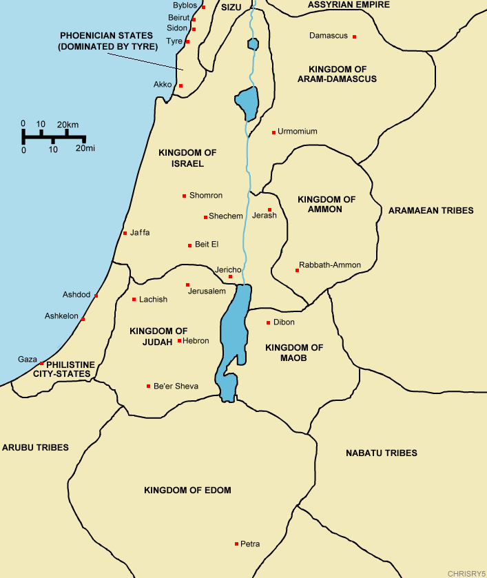
Created by ChrisRy5 using Macromedia Flash. City locations found on Wikipedia.
Map showing the ancient levant borders and ancient cities such as Urmomium and Jerash. The map also shows the region in the 9th century BCE. Notice the coastal land of Philistia, from which the name "Palestine" derives.
Correction: The kingdom to the east of the Dead Sea should be labeled the Kingdom of Moab.
许可协议
| Public domainPublic domainfalsefalse |
| 本作品已被作者ChrisRy5释出到公有领域。这适用于全世界。 在一些国家这可能不合法;如果是这样的话,那么: |
说明
添加一行文字以描述该文件所表现的内容
此文件中描述的项目
描绘内容
版权状态 简体中文(已转写)
受版权保护,并由版权所有者释出于公有领域 简体中文(已转写)
著作权持有者释出至公有领域 简体中文(已转写)
文件历史
点击某个日期/时间查看对应时刻的文件。
| 日期/时间 | 缩略图 | 大小 | 用户 | 备注 | |
|---|---|---|---|---|---|
| 当前 | 2006年12月18日 (一) 14:53 | | 707 × 839(82 KB) | Electionworld | {{ew|en|ChrisRy5}} == Summary == Created by ChrisRy5 using Macromedia Flash. City locations found on Wikipedia.<BR>Map showing the ancient levant borders and ancient cities such as Urmomium and Jerash. The map also shows the region in the 9th cent |
文件用途
没有页面使用本文件。
全域文件用途
以下其他wiki使用此文件:
- en.wikipedia.org上的用途
- he.wikipedia.org上的用途
- id.wikipedia.org上的用途
- ms.wikipedia.org上的用途
- pl.wikipedia.org上的用途
- sq.wikipedia.org上的用途