File:Corps-engineers-archives_bonneville_dam_looking_east.jpg
维基百科,自由的 encyclopedia
本预览的尺寸:800 × 533像素。 其他分辨率:320 × 213像素 | 640 × 426像素 | 1,024 × 682像素 | 1,500 × 999像素。
原始文件 (1,500 × 999像素,文件大小:228 KB,MIME类型:image/jpeg)
摘要
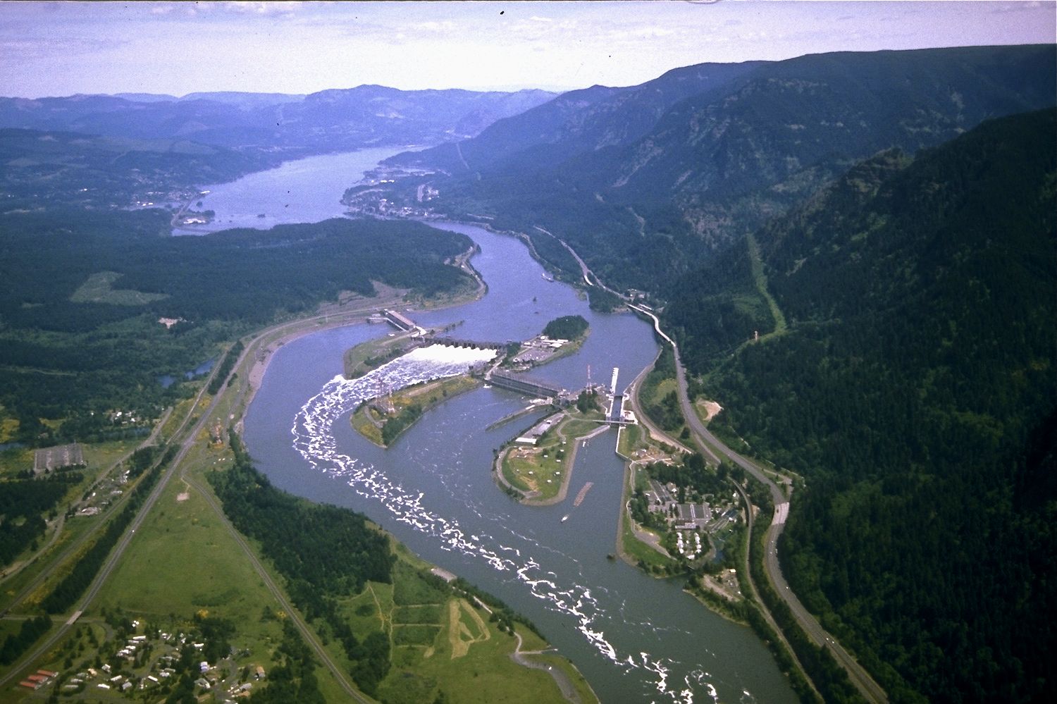
| 描述Corps-engineers-archives bonneville dam looking east.jpg | Aerial view of Columbia River and Bonneville Dam |
| 日期 | |
| 来源 | U.S. Army Corps of Engineers |
| 作者 | U.S. Army Corps of Engineers |
Secondary source: http://en.wikipedia.org/wiki/Image:Corps-engineers-archives_bonneville_dam_looking_east.jpg
许可协议
| Public domainPublic domainfalsefalse |
This image or file is a work of a U.S. Army Corps of Engineers soldier or employee, taken or made as part of that person's official duties. As a work of the U.S. federal government, the image is in the public domain.
English | italiano | Nederlands | پښتو | русский | sicilianu | slovenščina | Türkçe | українська | +/− |
de:Bild:Corps-engineers-archives_bonneville_dam_looking_east.jpg
说明
添加一行文字以描述该文件所表现的内容
Aerial view of Bonneville Dam, in the Columbia River Gorge, looking east. the bend visible in the river is a vestige of the original "Bridge of the Gods" land bridge.
此文件中描述的项目
描绘内容
2003
媒体类型 简体中文(已转写)
image/jpeg
数据大小 简体中文(已转写)
233,440 字节
999 像素
1,500 像素
文件历史
点击某个日期/时间查看对应时刻的文件。
| 日期/时间 | 缩略图 | 大小 | 用户 | 备注 | |
|---|---|---|---|---|---|
| 当前 | 2008年3月14日 (五) 22:19 | | 1,500 × 999(228 KB) | Peteforsyth | color corrected |
| 2008年3月14日 (五) 22:16 |  | 1,500 × 999(820 KB) | Peteforsyth | Highest quality original version (higher-res than the first one uploaded, no modifications except to convert from TIFF to 100% JPEG) | |
| 2008年3月14日 (五) 18:09 |  | 720 × 480(77 KB) | Peteforsyth | adjust color | |
| 2008年3月14日 (五) 18:08 |  | 720 × 480(77 KB) | Peteforsyth | adjust color | |
| 2006年5月24日 (三) 05:09 |  | 720 × 480(110 KB) | Mattes | {{Information| |Description=Aerial view of Columbia River and Bonneville Dam |Source=U.S. Army Corps of Engineers |Date=2003 |Author=U.S. Army Corps of Engineers |Permission={{PD-USGov}} |other_versions= }} Secondary source: http://en.wikipedia.org/wik |
文件用途
全域文件用途
以下其他wiki使用此文件:
- ast.wikipedia.org上的用途
- ba.wikipedia.org上的用途
- be-tarask.wikipedia.org上的用途
- be.wikipedia.org上的用途
- bg.wikipedia.org上的用途
- bh.wikipedia.org上的用途
- bn.wikipedia.org上的用途
- ceb.wikipedia.org上的用途
- cv.wikipedia.org上的用途
- de.wikipedia.org上的用途
- en.wikipedia.org上的用途
- Bonneville Dam
- List of dams in the Columbia River watershed
- List of National Historic Landmarks in Oregon
- Lake Bonneville (Oregon)
- National Register of Historic Places listings in Skamania County, Washington
- Wikipedia:Today's featured article/July 2017
- Wikipedia:Today's featured article/July 18, 2017
- Wikipedia:Main Page history/2017 July 18
- Nutrient cycling in the Columbia River Basin
- User:Nrchristman/sandbox
- Portal:Rivers/Selected article
- Portal:Rivers/Selected article/2
- en.wikivoyage.org上的用途
- es.wikipedia.org上的用途
- fa.wikipedia.org上的用途
- fr.wikipedia.org上的用途
- fy.wikipedia.org上的用途
- hr.wikipedia.org上的用途
- hy.wikipedia.org上的用途
- id.wikipedia.org上的用途
- io.wikipedia.org上的用途
- is.wikipedia.org上的用途
- it.wikipedia.org上的用途
- ja.wikipedia.org上的用途
- ka.wikipedia.org上的用途
- kk.wikipedia.org上的用途
- ko.wikipedia.org上的用途
- lv.wikipedia.org上的用途
- ml.wikipedia.org上的用途
- mn.wikipedia.org上的用途
- mr.wikipedia.org上的用途
- ms.wikipedia.org上的用途
- nl.wikipedia.org上的用途
查看此文件的更多全域用途。
元数据
此文件中包含有扩展的信息。这些信息可能是由数码相机或扫描仪在创建或数字化过程中所添加。
如果此文件的源文件已经被修改,一些信息在修改后的文件中将不能完全反映出来。
| 像素构成 | RGB |
|---|---|
| 方向 | 正常 |
| 水平分辨率 | 72 dpi |
| 垂直分辨率 | 72 dpi |
| 使用软件 | QuickTime 7.4.1 |
| 文件修改日期时间 | 2008年3月14日 (五) 14:45 |