Authagraph
地图投影法 来自维基百科,自由的百科全书
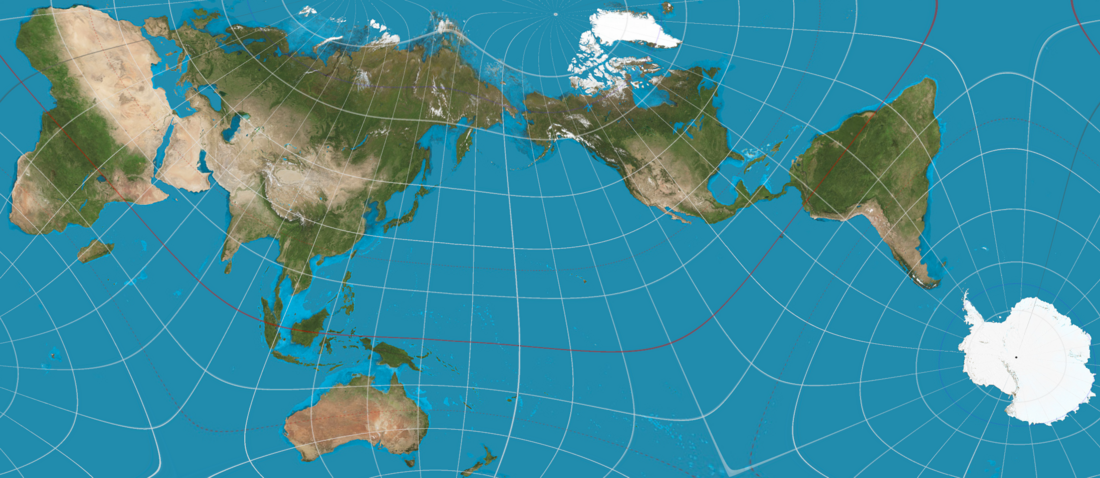
Authagraph(日語:オーサグラフ)是一種在長方形平面上,以盡可能不使比例失真的方式製作的一種新式地圖投影法,最初係由日本的建築師鳴川肇在1999年發表。這種投影法是透過將地球表面等分為96個球面三角形,並將其以各區域的面積比例不變的方式,投射在正四面體的平面上而製作成地圖[1]。由於Authagraph是已知的地圖投影法中,能同時將「維持地圖上各處面積比例」以及「將製成地圖時產生的變形平均分配至地球整體」兩點做得最周到的製圖法,除了能在地理學中應用,也被認為可應用在醫療與教育用途上[2]。
沒有或很少條目連入本條目。 (2017年9月29日) |

Authagraph投影法的名字是由「authalic」(等面積)和「graph」(圖)兩個字結合而成,意指能在長方形平面上以等比例方式呈現面積的地圖[1][3]。
歷史沿革
參見
參考來源
外部連結
Wikiwand - on
Seamless Wikipedia browsing. On steroids.
