拉布拉他河
南美洲河流 来自维基百科,自由的百科全书
拉布拉他河(西班牙語:Río de la Plata),或譯布拉他河[5],實際上是南美洲巴拉那河和烏拉圭河匯集後形成的一個河口灣。其名在西班牙語中意為「白銀之河」。
| 拉布拉他河 Río de la Plata | |
|---|---|
 | |
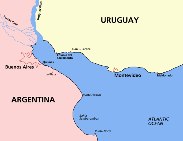
 Map of the Río de la Plata basin, showing the Río de la Plata at the mouths of the Paraná and Uruguay rivers, near Buenos Aires | |
| 別名 | River Plate, La Plata River |
| 詞源 | 西班牙語"白銀之河" |
| 國家 | |
| 城市 | La Plata, Buenos Aires, Montevideo, San Fernando, San Isidro, Vicente López, Avellaneda, Quilmes, Berazategui, Hudson, Punta Lara, Atalaya, San Clemente del Tuyú, Ciudad del Plata, Ciudad de la Costa, Colonia del Sacramento |
| 流域 | |
| 源頭 | Confluence of Paraná and Uruguay Rivers |
| • 位置 | 阿根廷和烏拉圭之間 |
| • 座標 | 34°0′5″S 58°23′37″W[1] |
| 河口 | 大西洋 |
| • 位置 | 阿根廷海 |
| • 座標 | 35°40′S 55°47′W[3] |
| 流域面積 | 3,170,000 km2(1,220,000 sq mi)[2] |
| 本貌 | |
| 長度 | 290 km(180 mi)[4] 4,876 km(3,030 mi) including the Paraná |
| 流量 | |
| • 平均流量 | 22,000 m3/s(780,000 cu ft/s)[4] |
| 特徵 | |
| 左岸支流 | 烏拉圭河, San Juan River, 亞瓜龍河 |
| 右岸支流 | 巴拉那河, 盧漢河, 薩拉多河 |

拉布拉他河位於南美洲東南部阿根廷和烏拉圭之間,河長約290公里,其寬度從西端兩河匯集處的48公里逐漸擴大至東部與大西洋相交處的220公里,最寬處約達290公里,是世界上最寬的河口。西北段因受大量河水注入,為淡水;東南段因海洋影響,為鹹水。阿根廷首都布宜諾斯艾利斯位於拉布拉他河西南岸,烏拉圭首都蒙特維多則位於東北岸處。 1502年為佛羅倫斯航海家亞美利哥·維斯普奇發現之,但此一發現被列為國家機密,1519年麥哲倫環球航行時,到此河口因其巨大,誤以為是穿越美洲的海峽,還派偵察船探路,直到一個星期後,遇到淡水才無功而返,繼續延著海岸航行到南美洲的最南端,真正發現麥哲倫海峽。
參見
參考資料
外部連結
Wikiwand - on
Seamless Wikipedia browsing. On steroids.
