File:Public_Schools_Historical_Atlas_-_Europe_13th_century.jpg
維基百科,自由的 encyclopedia
預覽大小:739 × 599 像素。 其他解析度:296 × 240 像素 | 592 × 480 像素 | 947 × 768 像素 | 1,132 × 918 像素。
原始檔案 (1,132 × 918 像素,檔案大小:374 KB,MIME 類型:image/jpeg)
摘要
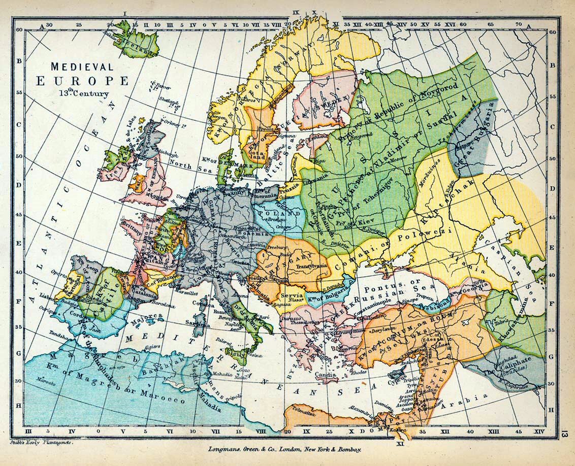
| 描述Public Schools Historical Atlas - Europe 13th century.jpg |
English: Map of Medieval Europe in the 13th Century. |
| 日期 | |
| 來源 |
|
| 作者 |
|
_en.png)
.png)
.jpg)
授權條款
| Public domainPublic domainfalsefalse |
|
|
 | |
 |
說明
添加單行說明來描述出檔案所代表的內容
pkkghhkhg
在此檔案描寫的項目
描繪內容
1905
多媒體型式 繁體中文 (已轉換拼寫)
image/jpeg
檔案歷史
點選日期/時間以檢視該時間的檔案版本。
| 日期/時間 | 縮圖 | 尺寸 | 用戶 | 備註 | |
|---|---|---|---|---|---|
| 目前 | 2009年6月19日 (五) 09:36 | | 1,132 × 918(374 KB) | Yarl | == {{int:filedesc}} == {{Information |Description={{en|Map of Medieval Europe in the 13th Century.}} |Source= * ''The Public Schools Historical Atlas'' by Charles Colbeck. Longmans, Green; New York; London; Bombay. 1905. * [http://www.lib.utexas.edu/maps/ |
檔案用途
沒有使用此檔案的頁面。
全域檔案使用狀況
以下其他 wiki 使用了這個檔案:
- en.wikipedia.org 的使用狀況
- fr.wiktionary.org 的使用狀況
- it.wikipedia.org 的使用狀況
- no.wikipedia.org 的使用狀況
詮釋資料
此檔案中包含擴展的資訊。這些資訊可能是由數位相機或掃描器在建立時或數位化過程中所加入。
如果此檔案的來源檔案已被修改,一些資訊在修改後的檔案中將不能完全反映出來。
| _error | 0 |
|---|