File:Europe_countries_map_en.png
維基百科,自由的 encyclopedia
預覽大小:737 × 600 像素。 其他解析度:295 × 240 像素 | 590 × 480 像素 | 944 × 768 像素 | 1,259 × 1,024 像素 | 1,475 × 1,200 像素。
原始檔案 (1,475 × 1,200 像素,檔案大小:612 KB,MIME 類型:image/png)
摘要
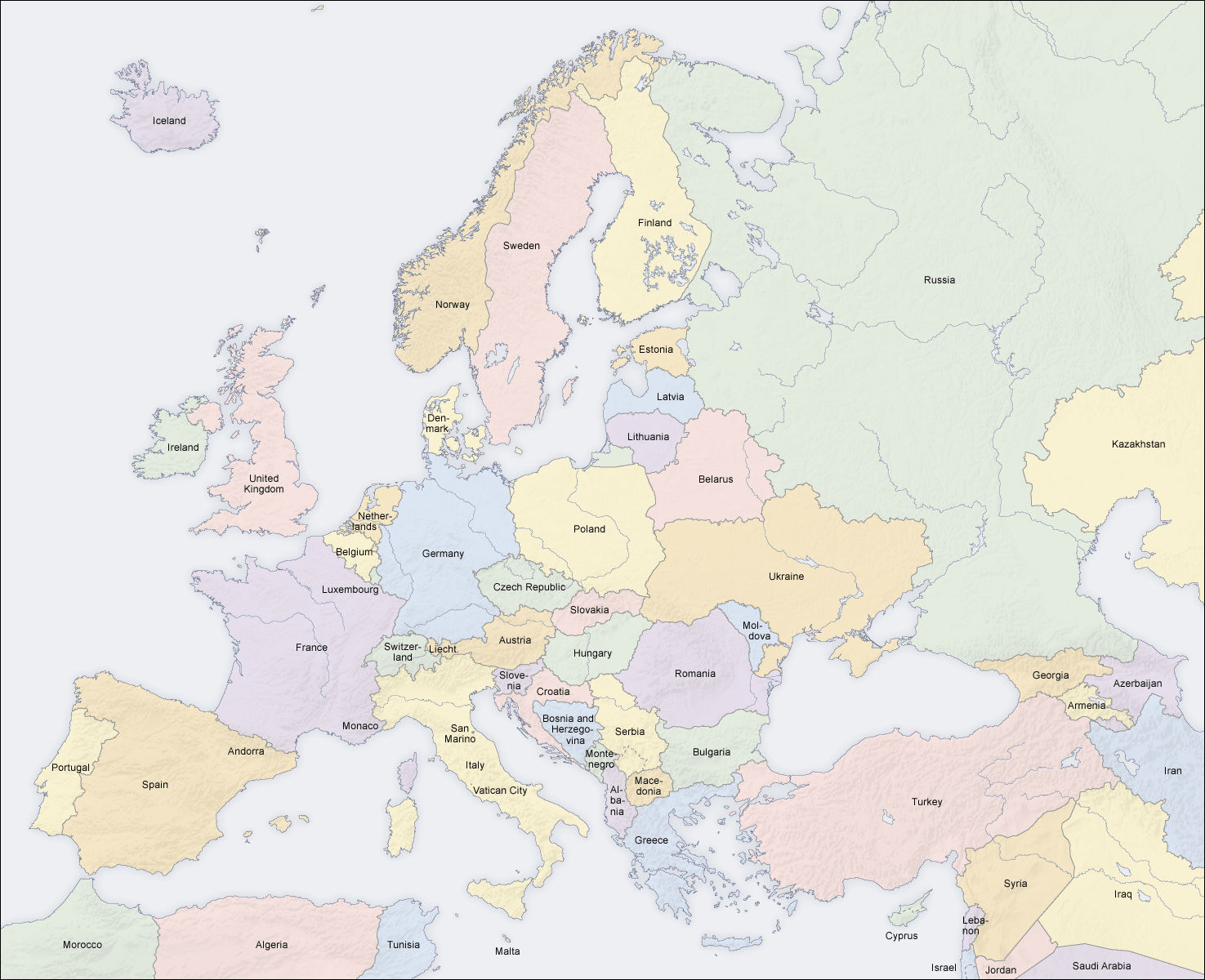
| 描述Europe countries map en.png |
English: Map of countries in Europe |
||||||||||
| 日期 | 02.04.2006 | ||||||||||
| 來源 | 自己的作品 (Original text: own map, based on the Generic Mapping Tools and ETOPO2) | ||||||||||
| 作者 | San Jose (map) | ||||||||||
| 授權許可 (重用此檔案) |
|
||||||||||
| 其他版本 |
Derivative works of this file: [編輯]
|


|
本圖片是以PNG、GIF或JPEG格式上傳。然而,其中包含的資料或訊息,應該重新建立成可縮放向量圖形(SVG)檔案,以更有效率或更準確的方式儲存。如有可能,請上傳本圖片的SVG格式版本。在上傳之後,請修改維基各姊妹計畫中所有使用舊版圖片的條目(列在圖像連結章節中),替換為新版圖片,並在舊圖片的描述頁中加入{{Vector version available|新圖片名稱.svg}}模板,同時移除本模板。
|
See also
_en.png)
.png)
.jpg)
說明
添加單行說明來描述出檔案所代表的內容
在此檔案描寫的項目
描繪內容
共享創意署名-相同方式共享3.0Unported Chinese (Hong Kong) (已轉換拼寫)
GNU自由文檔許可證1.2或更高版本 繁體中文 (已轉換拼寫)
檔案歷史
點選日期/時間以檢視該時間的檔案版本。
| 日期/時間 | 縮圖 | 尺寸 | 用戶 | 備註 | |
|---|---|---|---|---|---|
| 目前 | 2018年3月3日 (六) 14:49 | | 1,475 × 1,200(612 KB) | Wiz9999 | Reverted to version as of 08:37, 12 June 2008 (UTC) - Please use File:Europe countries map en 2.png to show disputed land. |
| 2017年11月22日 (三) 17:07 |  | 1,475 × 1,200(1.32 MB) | Мечников | update | |
| 2008年6月12日 (四) 08:37 |  | 1,475 × 1,200(612 KB) | San Jose | update | |
| 2006年6月5日 (一) 11:52 |  | 1,475 × 1,200(658 KB) | San Jose | updated and corrected | |
| 2006年6月4日 (日) 14:58 |  | 1,475 × 1,200(611 KB) | Roke~commonswiki | montenegro independent now | |
| 2006年4月2日 (日) 11:14 |  | 1,475 × 1,200(661 KB) | San Jose | Upload |
檔案用途
沒有使用此檔案的頁面。
全域檔案使用狀況
以下其他 wiki 使用了這個檔案:
- da.wikipedia.org 的使用狀況
- de.wikipedia.org 的使用狀況
- en.wikipedia.org 的使用狀況
- haw.wikipedia.org 的使用狀況
- he.wikipedia.org 的使用狀況
- hyw.wikipedia.org 的使用狀況
- ilo.wikipedia.org 的使用狀況
- nl.wikinews.org 的使用狀況
- pag.wikipedia.org 的使用狀況
- roa-rup.wikipedia.org 的使用狀況
- ro.wikipedia.org 的使用狀況
- simple.wiktionary.org 的使用狀況
- su.wikipedia.org 的使用狀況
- ta.wikipedia.org 的使用狀況
- uk.wikipedia.org 的使用狀況
詮釋資料
此檔案中包含擴展的資訊。這些資訊可能是由數位相機或掃描器在建立時或數位化過程中所加入。
如果此檔案的來源檔案已被修改,一些資訊在修改後的檔案中將不能完全反映出來。
| 使用軟體 |
|---|