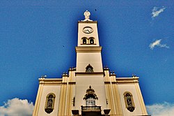
阿普卡拉納
来自维基百科,自由的百科全书
此條目可參照外語維基百科相應條目來擴充。 (2017年5月7日) |
阿普卡拉納(葡萄牙語:Apucarana)是位於巴西南部巴拉那州的一座城市。面積548平方公里(212平方英里),海拔高度840米(2,760英尺),2008年人口120,133人。[1]
人口

該城有來自葡萄牙、烏克蘭、波蘭、德國,以及尤其是日本的移民。受日裔移民影響,該城市廣泛種植櫻花,並在花季時舉辦櫻花節。[2]
| 阿普卡拉納人口種族 | |
|---|---|
| 白人 | 71.95% |
| 棕種人 | 17.84% |
| 黑人 | 5.97% |
| 亞裔 | 3.77% |
| 原住民 | 0.47% |
參考資料
Wikiwand in your browser!
Seamless Wikipedia browsing. On steroids.
Every time you click a link to Wikipedia, Wiktionary or Wikiquote in your browser's search results, it will show the modern Wikiwand interface.
Wikiwand extension is a five stars, simple, with minimum permission required to keep your browsing private, safe and transparent.


