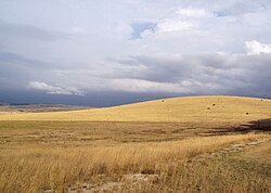
科斯 (法國)
高原 来自维基百科,自由的百科全书
科斯(法語:Causses,法語發音:[kos]),又稱喀斯,是法國的一個石灰岩高原,位於法國中央高原。科斯平均高度在900~1000米,石灰岩台地密集。由於侵蝕作用的影響,有眾多很深的谷地,形成喀斯特地形,亦有許多外觀奇特的岩石。科斯是法國主要的牧羊地區之一,是著名的羊乳起司產地,同時科斯還被指定為自然公園。2011年,科斯因其農業景觀而被指定為世界文化遺產[1]。
參考資料
Wikiwand in your browser!
Seamless Wikipedia browsing. On steroids.
Every time you click a link to Wikipedia, Wiktionary or Wikiquote in your browser's search results, it will show the modern Wikiwand interface.
Wikiwand extension is a five stars, simple, with minimum permission required to keep your browsing private, safe and transparent.


