馬瓦西
来自维基百科,自由的百科全书
馬瓦西 (阿拉伯語:المواصي)是加沙地帶境內的一個農業區,[1]寬約一公里,長約十四公里。當地被稱為加沙地帶的糧倉。 [2]在2005年以色列撤離加沙之前,當地是一個以色列定居點。根據巴勒斯坦中央統計局的數據,2006年馬瓦西的人口為 1,409人。
| 馬瓦西 | |
|---|---|
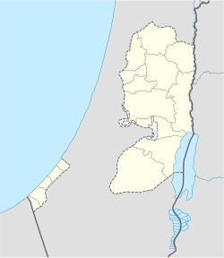
馬瓦西在巴勒斯坦國境內所處的位置 | |
| 坐標:31°19′44″N 34°13′48″E | |
| 國家 | 巴勒斯坦國 |
| 巴勒斯坦行政區劃 | 拉法省 |
| 人口(2006) | |
| • 總計 | 1,400人 |
參考文獻
Wikiwand - on
Seamless Wikipedia browsing. On steroids.

