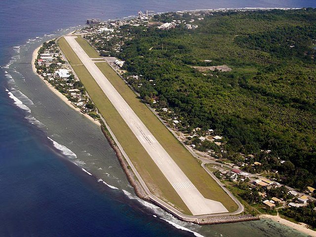
根據柯本氣候分類法,亞倫區屬熱帶雨林氣候,全年高溫多雨無乾季,每年12月至翌年2月之降水量有較明顯的增加。
更多資訊 亞倫區, 月份 ...
| 亞倫區
|
| 月份
|
1月
|
2月
|
3月
|
4月
|
5月
|
6月
|
7月
|
8月
|
9月
|
10月
|
11月
|
12月
|
全年
|
| 歷史最高溫 °C(°F)
|
34.0
(93.2)
|
37.0
(98.6)
|
35.0
(95.0)
|
35.0
(95.0)
|
32.0
(89.6)
|
32.0
(89.6)
|
35.0
(95.0)
|
33.0
(91.4)
|
35.0
(95.0)
|
34.0
(93.2)
|
36.0
(96.8)
|
35.0
(95.0)
|
37.0
(98.6)
|
| 平均高溫 °C(°F)
|
30
(86)
|
30
(86)
|
30
(86)
|
30
(86)
|
30
(86)
|
30
(86)
|
30
(86)
|
30
(86)
|
30
(86)
|
31
(88)
|
31
(88)
|
31
(88)
|
30
(87)
|
| 平均低溫 °C(°F)
|
25
(77)
|
25
(77)
|
25
(77)
|
25
(77)
|
25
(77)
|
25
(77)
|
25
(77)
|
25
(77)
|
25
(77)
|
25
(77)
|
25
(77)
|
25
(77)
|
25
(77)
|
| 歷史最低溫 °C(°F)
|
21.0
(69.8)
|
21.0
(69.8)
|
21.0
(69.8)
|
21.0
(69.8)
|
20.0
(68.0)
|
21.0
(69.8)
|
20.0
(68.0)
|
21.0
(69.8)
|
20.0
(68.0)
|
21.0
(69.8)
|
21.0
(69.8)
|
21.0
(69.8)
|
20.0
(68.0)
|
| 平均降水量 mm(吋)
|
280
(11.0)
|
250
(9.8)
|
190
(7.5)
|
190
(7.5)
|
120
(4.7)
|
110
(4.3)
|
150
(5.9)
|
130
(5.1)
|
120
(4.7)
|
100
(3.9)
|
120
(4.7)
|
280
(11.0)
|
2,080
(81.9)
|
| 平均降水天數
|
16
|
14
|
13
|
11
|
9
|
9
|
12
|
14
|
11
|
10
|
13
|
15
|
152
|
| 數據來源:Weatherbase
|
關閉


