File:Tropical_Storm_Nangka_2003.jpg
維基百科,自由的 encyclopedia
預覽大小:465 × 600 像素。 其他解析度:186 × 240 像素 | 372 × 480 像素 | 595 × 768 像素 | 793 × 1,024 像素 | 1,587 × 2,048 像素 | 6,200 × 8,000 像素。
原始檔案 (6,200 × 8,000 像素,檔案大小:9.86 MB,MIME 類型:image/jpeg)
摘要
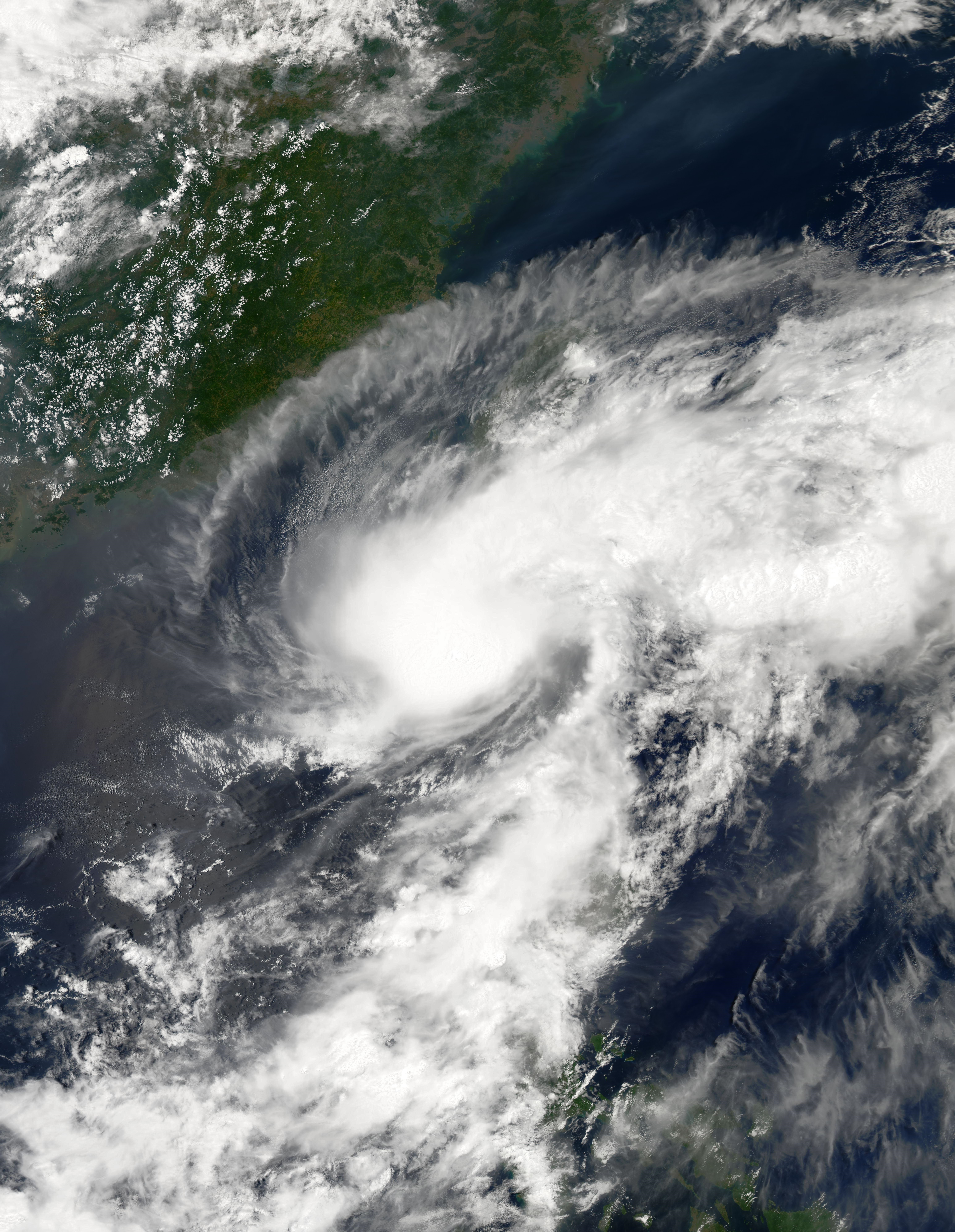
| 描述Tropical Storm Nangka 2003.jpg | This image shows Tropical Storm Nangka on its way to Taiwan on 0530 UTC on June 02, 2003. The storm's maximum sustained wind speeds were at their peak of 50 knots. | ||||||
| 日期 | |||||||
| 來源 | http://modis-atmos.gsfc.nasa.gov/IMAGES/MYD02/GRANULE/2003_06_02/153.0530.rgb143.jpg | ||||||
| 作者 | Moderate Resolution Imaging Spectroradiometer (MODIS) image from NASA's Aqua satellite | ||||||
| 授權許可 (重用此檔案) |
|

說明
添加單行說明來描述出檔案所代表的內容
在此檔案描寫的項目
描繪內容
2 6 2003
檔案歷史
點選日期/時間以檢視該時間的檔案版本。
| 日期/時間 | 縮圖 | 尺寸 | 用戶 | 備註 | |
|---|---|---|---|---|---|
| 目前 | 2023年7月31日 (一) 18:55 | | 6,200 × 8,000(9.86 MB) | Sandy14156 | decreased brightness + fixed proportions |
| 2017年12月12日 (二) 03:46 |  | 5,633 × 5,793(2.91 MB) | TheAustinMan | Higher resolution and grid-less | |
| 2006年9月8日 (五) 21:07 |  | 700 × 700(121 KB) | Good kitty | == Summary == {{Information |Description=This image shows Tropical Storm Nangka on its way to Taiwan on 0530 UTC on June 02, 2003. The storm's maximum sustained wind speeds were at their peak of 50 knots. |Source=http://modis-atmos.gsfc.nasa.gov/IMAGES/MY |
檔案用途
下列2個頁面有用到此檔案:
全域檔案使用狀況
以下其他 wiki 使用了這個檔案:
- en.wikipedia.org 的使用狀況
- ja.wikipedia.org 的使用狀況
- ko.wikipedia.org 的使用狀況
- pt.wikipedia.org 的使用狀況
- th.wikipedia.org 的使用狀況
- vi.wikipedia.org 的使用狀況
詮釋資料
此檔案中包含擴展的資訊。這些資訊可能是由數位相機或掃描器在建立時或數位化過程中所加入。
如果此檔案的來源檔案已被修改,一些資訊在修改後的檔案中將不能完全反映出來。
| 水平解析度 | 96 dpi |
|---|---|
| 垂直解析度 | 96 dpi |
| 使用軟體 | paint.net 5.0.7 |