File:ScotlandSouthAyrshire.png
維基百科,自由的 encyclopedia
此為最大尺寸。
ScotlandSouthAyrshire.png (200 × 230 像素,檔案大小:4 KB,MIME 類型:image/png)
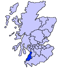
South Ayrshire unitary council
Slightly edited version of a map drawn by Morwen

|
已授權您依據自由軟體基金會發行的無固定段落、封面文字和封底文字GNU自由文件授權條款1.2版或任意後續版本,對本檔進行複製、傳播和/或修改。該協議的副本列在GNU自由文件授權條款中。http://www.gnu.org/copyleft/fdl.htmlGFDLGNU Free Documentation Licensetruetrue |
| 此檔案採用共享創意 姓名標示-相同方式分享 3.0 未在地化版本授權條款。 | ||
| ||
| 已新增授權條款標題至此檔案,作為GFDL授權更新的一部份。http://creativecommons.org/licenses/by-sa/3.0/CC BY-SA 3.0Creative Commons Attribution-Share Alike 3.0truetrue |
說明
添加單行說明來描述出檔案所代表的內容
在此檔案描寫的項目
描繪內容
GNU自由文檔許可證1.2或更高版本 繁體中文 (已轉換拼寫)
檔案歷史
點選日期/時間以檢視該時間的檔案版本。
| 日期/時間 | 縮圖 | 尺寸 | 用戶 | 備註 | |
|---|---|---|---|---|---|
| 目前 | 2005年5月17日 (二) 21:41 | | 200 × 230(4 KB) | Voyager | |
| 2005年5月17日 (二) 21:40 |  | 200 × 230(4 KB) | Voyager | South Ayrshire unitary council Slightly edited version of a map drawn by Morwen {{GFDL}} Category:Maps of Scottish unitary councils |
檔案用途
下列頁面有用到此檔案:
全域檔案使用狀況
以下其他 wiki 使用了這個檔案:
- be.wikipedia.org 的使用狀況
- bg.wikipedia.org 的使用狀況
- cy.wikipedia.org 的使用狀況
- de.wikipedia.org 的使用狀況
- en.wikipedia.org 的使用狀況
- eu.wikipedia.org 的使用狀況
- Hegoaldeko Ayrshire
- Ayr
- Lankide:Euskaldunaa
- Maybole
- Prestwick
- Txantiloi:Hegoaldeko Ayrshire
- Wikiproiektu:Irlanda, Gales eta Eskoziako udalerriak
- Alloway
- Girvan
- Troon
- Annbank
- Ballantrae
- Barassie (Hegoaldeko Ayrshire)
- Coylton
- Craigie Udalerria eta Parrokia
- Dundonald (South Ayrshire)
- Failford
- Heronsford
- Joppa (Hegoaldeko Ayrshire)
- Loans (Hegoaldeko Ayrshire)
- Millmannoch
- Monkton (Ayrshire)
- Mossblown
- Old Rome (Hegoaldeko Ayrshire)
- Symington (Hegoaldeko Ayrshire)
- Tarbolton
- Barr (Ayrshire)
- Barrhill (Hegoaldeko Ayrshire)
- Colmonell
- Crosshill (Hegoaldeko Ayrshire)
- Dailly
- Dunure
- Kirkmichael
- Kirkoswald (Hegoaldeko Ayrshire)
- Maidens
- Minishant
- Old Dailly
- Straiton
- Belmont (Ayr)
- Doonfoot
- Montgomerieston
- Heathfield (Hegoaldeko Ayrshire)
- Kincaidston
檢視此檔案的更多全域使用狀況。