File:Pentagon_77.05629W_38.png
維基百科,自由的 encyclopedia
預覽大小:800 × 527 像素。 其他解析度:320 × 211 像素 | 640 × 421 像素 | 992 × 653 像素。
原始檔案 (992 × 653 像素,檔案大小:1.31 MB,MIME 類型:image/png)
摘要
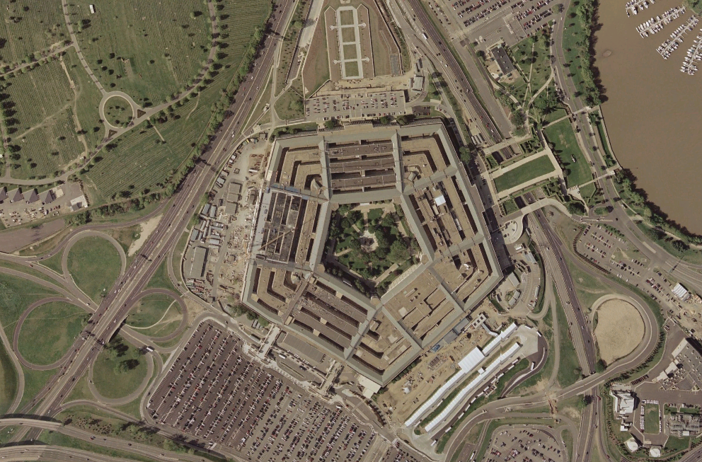
| 描述Pentagon 77.05629W 38.png |
English: The Pentagon in April 2002. |
| 日期 | |
| 來源 | World Wind |
| 作者 | NASA |
| 其他版本 |
|


| 拍攝地點 | 38° 53′ 42″ 北, 77° 02′ 13.2″ 西 | 位於此地的本圖片與其他圖片: OpenStreetMap |
|---|
授權條款
| Public domainPublic domainfalsefalse |
| 本圖像屬於公有領域,因其為NASA的World Wind衛星地圖瀏覽器的一張截圖,且使用了公有領域圖層,如Blue Marble、MODIS、Landsat、SRTM、USGS、GLOBE等。
العربيَّة | English | فارسی | français | עברית | македонски | മലയാളം | Nederlands | русский | 中文(中国大陆) | +/− |
 |
| 註解 InfoField | 該圖片含有註解:在維基媒體共享資源上查看註解 |
353
278
88
93
992
653
Phoenix Project
說明
添加單行說明來描述出檔案所代表的內容
在此檔案描寫的項目
描繪內容
4月 2002
視角坐標 繁體中文 (已轉換拼寫)
38°53'42"N, 77°2'13"W
檔案歷史
點選日期/時間以檢視該時間的檔案版本。
| 日期/時間 | 縮圖 | 尺寸 | 用戶 | 備註 | |
|---|---|---|---|---|---|
| 目前 | 2005年10月28日 (五) 15:21 | | 992 × 653(1.31 MB) | David.Monniaux | The Pentagon latitude: 38.895N longitude: 77.037W {{PD-WorldWind}} |
檔案用途
沒有使用此檔案的頁面。
全域檔案使用狀況
以下其他 wiki 使用了這個檔案:
- eo.wikipedia.org 的使用狀況
- fr.wikipedia.org 的使用狀況
- it.wikipedia.org 的使用狀況
- ja.wikipedia.org 的使用狀況
- ko.wikipedia.org 的使用狀況
- ko.wiktionary.org 的使用狀況
- ml.wikipedia.org 的使用狀況
- nl.wikipedia.org 的使用狀況
- ru.wiktionary.org 的使用狀況
- sv.wikipedia.org 的使用狀況
- vi.wikipedia.org 的使用狀況