File:World_map_indicating_tropics_and_subtropics.png
維基百科,自由的 encyclopedia
預覽大小:800 × 447 像素。 其他解析度:320 × 179 像素 | 640 × 357 像素 | 1,024 × 572 像素 | 1,280 × 715 像素 | 2,000 × 1,117 像素。
原始檔案 (2,000 × 1,117 像素,檔案大小:131 KB,MIME 類型:image/png)
摘要
| 描述World map indicating tropics and subtropics.png |
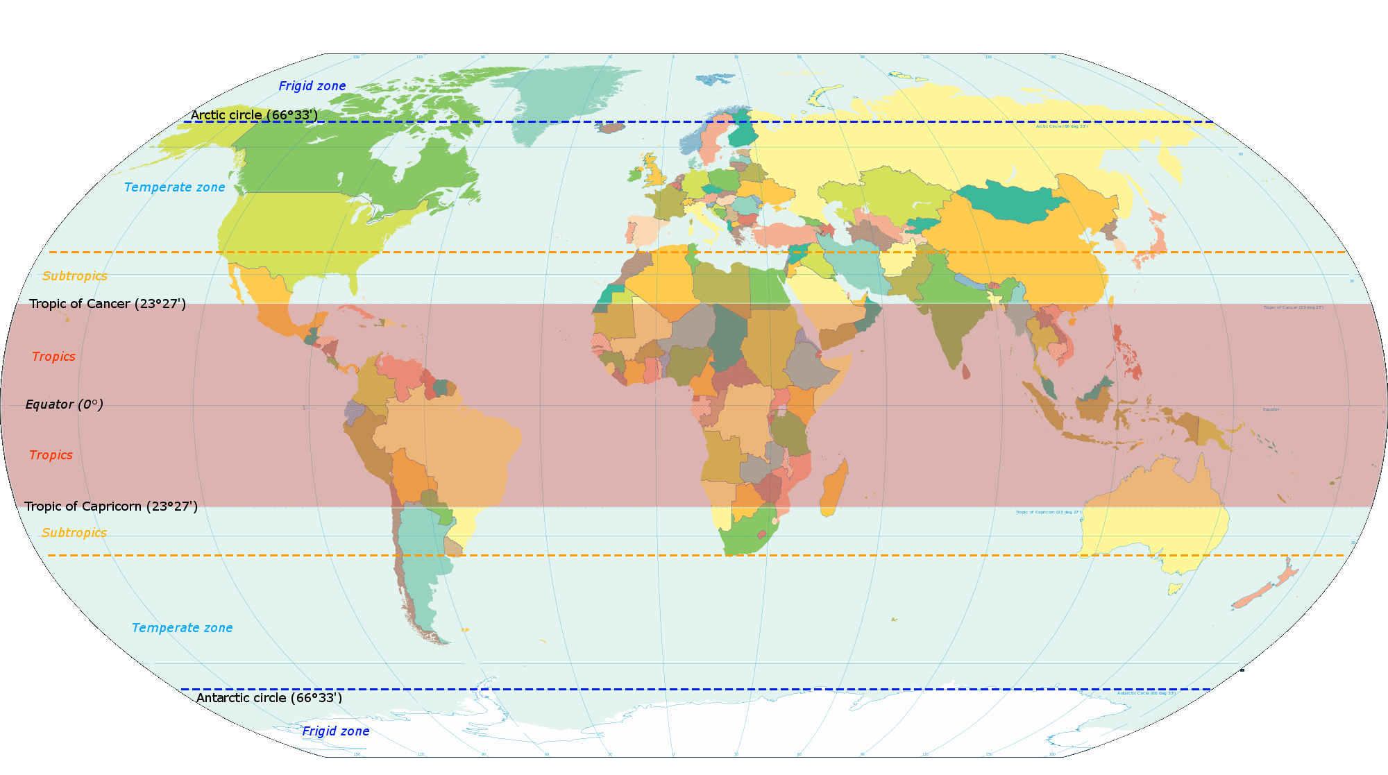
English: Map based on File:World map torrid.svg, now indicating subtropics. Map was made by closely examining this map to get latitude accurately correct. |
| 日期 | |
| 來源 | 自己的作品 |
| 作者 | KVDP |
授權條款
我,本作品的著作權持有者,決定用以下授權條款發佈本作品:
此檔案採用創用CC 姓名標示-相同方式分享 3.0 未在地化版本授權條款。
- 您可以自由:
- 分享 – 複製、發佈和傳播本作品
- 重新修改 – 創作演繹作品
- 惟需遵照下列條件:
- 姓名標示 – 您必須指名出正確的製作者,和提供授權條款的連結,以及表示是否有對內容上做出變更。您可以用任何合理的方式來行動,但不得以任何方式表明授權條款是對您許可或是由您所使用。
- 相同方式分享 – 如果您利用本素材進行再混合、轉換或創作,您必須基於如同原先的相同或兼容的條款,來分布您的貢獻成品。
說明
添加單行說明來描述出檔案所代表的內容
The subtropics and tropics
22 7 2013
檔案歷史
點選日期/時間以檢視該時間的檔案版本。
| 日期/時間 | 縮圖 | 尺寸 | 使用者 | 備註 | |
|---|---|---|---|---|---|
| 目前 | 2014年3月13日 (四) 18:13 | | 2,000 × 1,117(131 KB) | Genetics4good | Reverted to version as of 10:31, 20 November 2013 |
| 2014年3月13日 (四) 18:09 |  | 2,000 × 1,117(465 KB) | Genetics4good | Reverted to version as of 06:44, 23 July 2013 | |
| 2013年11月20日 (三) 10:31 |  | 2,000 × 1,117(131 KB) | Maproom | My fourth attempt. I am making a real mess of this. | |
| 2013年11月19日 (二) 18:46 |  | 2,000 × 1,117(131 KB) | Maproom | A third attempt, with the corrections AND the transparency this time, I hope. | |
| 2013年11月13日 (三) 10:28 |  | 2,000 × 1,117(131 KB) | Maproom | Restored background transparency, which I had accidentally removed | |
| 2013年11月13日 (三) 10:23 |  | 2,000 × 1,117(422 KB) | Maproom | Removed labels "68" on two lines of latitude - the lines are in the right position (as limits of subtropical zone), but are not at 68 north and south. Added a "c" to "Antarctic". | |
| 2013年7月23日 (二) 06:44 |  | 2,000 × 1,117(465 KB) | Genetics4good | Added temperate and frigid zone | |
| 2013年7月22日 (一) 15:53 |  | 2,000 × 1,117(452 KB) | Genetics4good | User created page with UploadWizard |
檔案用途
全域檔案使用狀況
以下其他 wiki 使用了這個檔案:
- ar.wikipedia.org 的使用狀況
- arz.wikipedia.org 的使用狀況
- bg.wikipedia.org 的使用狀況
- bh.wikipedia.org 的使用狀況
- bn.wikipedia.org 的使用狀況
- ca.wikipedia.org 的使用狀況
- en.wikipedia.org 的使用狀況
- en.wikiversity.org 的使用狀況
- en.wikivoyage.org 的使用狀況
- en.wiktionary.org 的使用狀況
- fi.wikipedia.org 的使用狀況
- fi.wiktionary.org 的使用狀況
- ga.wikipedia.org 的使用狀況
- gv.wikipedia.org 的使用狀況
- ha.wikipedia.org 的使用狀況
- he.wikivoyage.org 的使用狀況
- id.wikipedia.org 的使用狀況
- ilo.wikipedia.org 的使用狀況
- ms.wikipedia.org 的使用狀況
- my.wikipedia.org 的使用狀況
- ro.wikipedia.org 的使用狀況
- sco.wikipedia.org 的使用狀況
- sd.wikipedia.org 的使用狀況
- si.wikipedia.org 的使用狀況
- sr.wikipedia.org 的使用狀況
- su.wikipedia.org 的使用狀況
- th.wikipedia.org 的使用狀況
- tr.wikipedia.org 的使用狀況
- ur.wikipedia.org 的使用狀況
- war.wikipedia.org 的使用狀況
- www.wikidata.org 的使用狀況
- zh-yue.wikipedia.org 的使用狀況
詮釋資料
此檔案中包含其他資訊,這些資訊可能是由數位相機或掃描器在建立或數位化過程中所新增的。若檔案自原始狀態已被修改,一些詳細資料可能無法完整反映出已修改的檔案。
| 數位化的日期時間 |
|
|---|---|
| 檔案修改日期時間 | 2013年11月20日 (三) 10:27 |
| 水平解析度 | 28.34 dpc |
| 垂直解析度 | 28.34 dpc |