File:Whiting_bros.jpg
維基百科,自由的 encyclopedia
預覽大小:800 × 551 像素。 其他解析度:320 × 220 像素 | 640 × 440 像素 | 1,024 × 705 像素 | 1,280 × 881 像素 | 2,560 × 1,762 像素 | 3,310 × 2,278 像素。
原始檔案 (3,310 × 2,278 像素,檔案大小:1.51 MB,MIME 類型:image/jpeg)
摘要
| 描述Whiting bros.jpg |
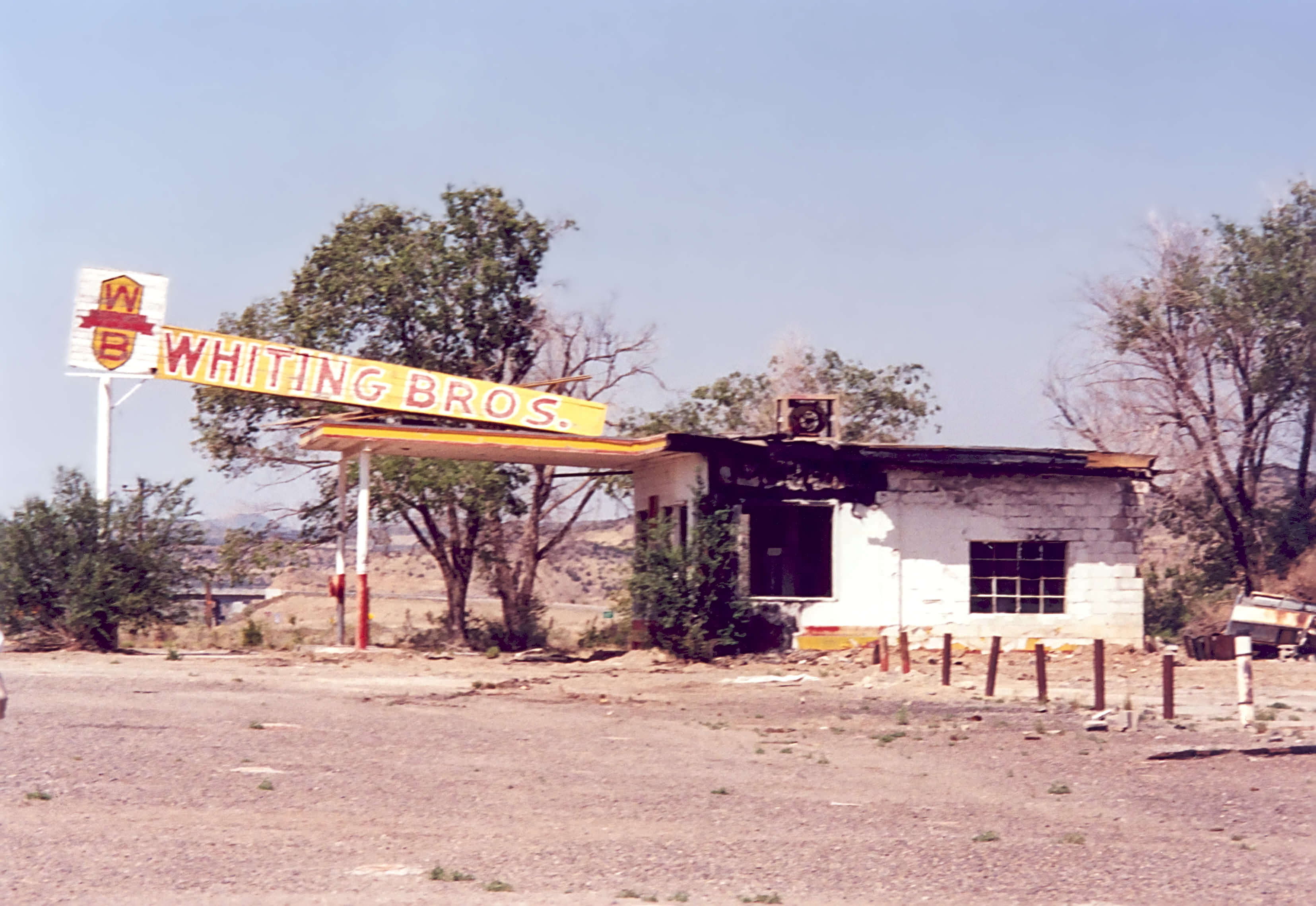
English: Whiting Brothers Gas Station, New Mexico. Though abandoned years ago due to fire damage, historic buildings such as Whiting Brothers are fought for to be protected in their current conditions. NRHP listing is for 66 Rural Historic District: Laguna to McCarty's - Cibola County (added 1994) |
| 日期 | |
| 來源 | http://www.fhwa.dot.gov/byways/photos/46264 |
| 作者 | Kellie Thorne |
| 授權許可 (重用此檔案) |
Public domain. At the website the words "public domain" can be seen below this photo |
| 目標地點 | 35° 04′ 37.92″ 北, 107° 38′ 50.64″ 西 | 位於此地的本圖片與其他圖片: OpenStreetMap |
|---|
授權條款
| Public domainPublic domainfalsefalse |
| This image is a work of a United States Department of Transportation employee, taken or made as part of that person's official duties. As a work of the U.S. federal government, the image is in the public domain.
|
說明
添加單行說明來描述出檔案所代表的內容
在此檔案描寫的項目
描繪內容
5月 2003
描述地坐標 中文 (已轉換拼寫)
35°4'37.9"N, 107°38'50.6"W
image/jpeg
檔案歷史
點選日期/時間以檢視該時間的檔案版本。
| 日期/時間 | 縮圖 | 尺寸 | 使用者 | 備註 | |
|---|---|---|---|---|---|
| 目前 | 2014年4月4日 (五) 01:17 | | 3,310 × 2,278(1.51 MB) | Junkyardsparkle | White balance, sharpen, noise reduction, dust and scratch removal. |
| 2006年3月15日 (三) 16:28 |  | 3,310 × 2,278(449 KB) | Mauriziogio | From http://www.byways.org/browse/byways/2087/photos.html?display_mode=single&pub_id=46264&order_no=11 {{PD-USGov-DOT}} |
檔案用途
下列頁面有用到此檔案:
全域檔案使用狀況
以下其他 wiki 使用了這個檔案:
- en.wikipedia.org 的使用狀況
- hu.wikipedia.org 的使用狀況
- it.wikipedia.org 的使用狀況
- pt.wikipedia.org 的使用狀況
- www.wikidata.org 的使用狀況