File:Karte_Verwaltungsgliederung_Äthiopien_1987-1991.png
維基百科,自由的 encyclopedia
預覽大小:570 × 600 像素。 其他解析度:228 × 240 像素 | 456 × 480 像素 | 730 × 768 像素 | 1,266 × 1,332 像素。
原始檔案 (1,266 × 1,332 像素,檔案大小:203 KB,MIME 類型:image/png)
摘要
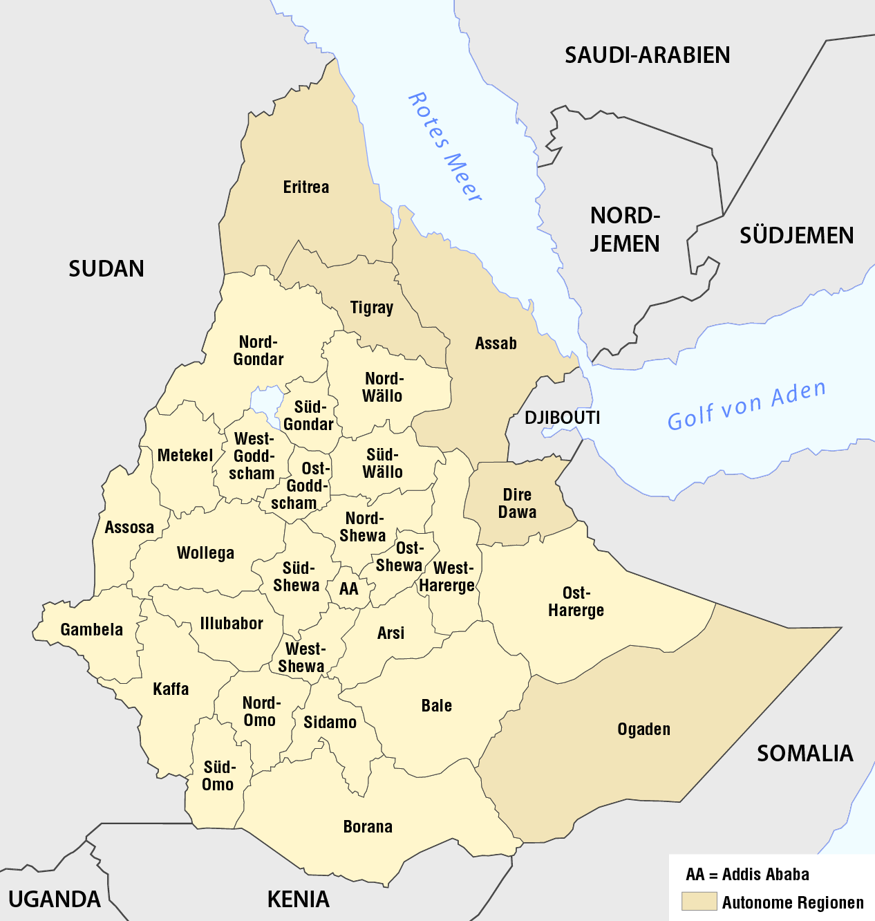
| 描述Karte Verwaltungsgliederung Äthiopien 1987-1991.png |
Deutsch: Karte der Verwaltungsgliederung Äthiopiens 1987-1991
English: Map of the 30 regions of Ethiopia, 1987-1991 |
| 日期 | see file history |
| 來源 |
自己的作品, using the information from |
| 作者 | Maximilian Dörrbecker (Chumwa) |
| 授權許可 (重用此檔案) |
我,本作品的著作權持有者,決定用以下授權條款發佈本作品: 此檔案採用創用CC 姓名標示-相同方式分享 2.5 通用版授權條款。
Sie dürfen das Bild zu den folgenden Bedingungen nutzen:
|
說明
添加單行說明來描述出檔案所代表的內容
在此檔案描寫的項目
描繪內容
檔案歷史
點選日期/時間以檢視該時間的檔案版本。
| 日期/時間 | 縮圖 | 尺寸 | 使用者 | 備註 | |
|---|---|---|---|---|---|
| 目前 | 2016年10月23日 (日) 06:53 | | 1,266 × 1,332(203 KB) | Chumwa | corr |
| 2013年11月17日 (日) 11:37 |  | 1,266 × 1,332(203 KB) | Chumwa | == {{int:filedesc}} == {{Information |Description = {{de|1=Karte der Verwaltungsgliederung Äthiopiens 1987-1991}} |Source = {{own}}, using the information from Negussay Ayele: [ http://www.ethiopians.com/Negussay_NaturalSeaShores.htm On Ethi... |
檔案用途
下列頁面有用到此檔案:
全域檔案使用狀況
以下其他 wiki 使用了這個檔案:
- de.wikipedia.org 的使用狀況
- fr.wikipedia.org 的使用狀況
- sv.wikipedia.org 的使用狀況
- uk.wikipedia.org 的使用狀況
詮釋資料
此檔案中包含其他資訊,這些資訊可能是由數位相機或掃描器在建立或數位化過程中所新增的。若檔案自原始狀態已被修改,一些詳細資料可能無法完整反映出已修改的檔案。
| 水平解析度 | 118.11 dpc |
|---|---|
| 垂直解析度 | 118.11 dpc |
| 使用軟體 |