File:Rhineland_p_kl.png
維基百科,自由的 encyclopedia
無更高解析度可提供。
Rhineland_p_kl.png (419 × 503 像素,檔案大小:13 KB,MIME 類型:image/png)
摘要
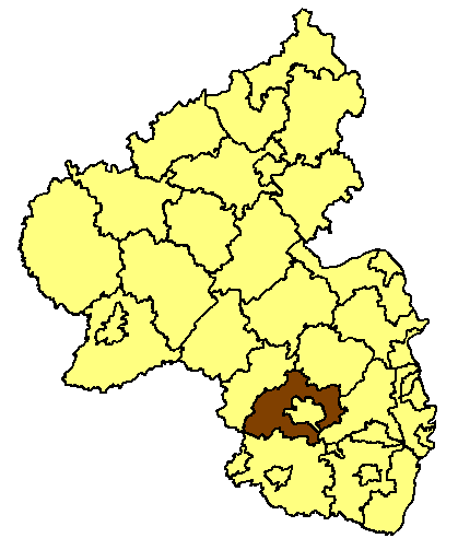
Karte des Landkreis Kaiserslautern
Karten sind selbst erstellt, durch Ausmalen der Vorlage Image:Rhineland p template.png.
Moved from de.wikipedia.org, first uploaded by de:Benutzer:Fusslkopp, colored by de:Benutzer:AHoerstemeier.
授權條款

|
已授權您依據自由軟體基金會發行的無固定段落、封面文字和封底文字GNU自由文件授權條款1.2版或任意後續版本,對本檔進行複製、傳播和/或修改。該協議的副本列在GNU自由文件授權條款中。http://www.gnu.org/copyleft/fdl.htmlGFDLGNU Free Documentation Licensetruetrue |
| 此檔案採用創用CC 姓名標示-相同方式分享 3.0 未在地化版本授權條款。 | ||
| ||
| 已新增授權條款標題至此檔案,作為GFDL授權更新的一部份。http://creativecommons.org/licenses/by-sa/3.0/CC BY-SA 3.0Creative Commons Attribution-Share Alike 3.0truetrue |
說明
添加單行說明來描述出檔案所代表的內容
在此檔案描寫的項目
描繪內容
檔案歷史
點選日期/時間以檢視該時間的檔案版本。
| 日期/時間 | 縮圖 | 尺寸 | 使用者 | 備註 | |
|---|---|---|---|---|---|
| 目前 | 2008年9月4日 (四) 19:40 | | 419 × 503(13 KB) | Rp. | |
| 2006年2月28日 (二) 12:19 |  | 188 × 245(10 KB) | Tsca.bot | Karte des Landkreis Kaiserslautern Diese Karte basiert auf en:Wikipedia:WikiProject German districts/Maptemplates von en:User:Baldhur. Eingefärbt wurde sie von en:User:Ahoerstemeier. [[en:Image:{{PAGENAME}}]] {{GFDL}} [[Category:Map |
檔案用途
全域檔案使用狀況
以下其他 wiki 使用了這個檔案:
- ka.wikipedia.org 的使用狀況
- kk.wikipedia.org 的使用狀況
- ms.wikipedia.org 的使用狀況
- pnb.wikipedia.org 的使用狀況
- ro.wikipedia.org 的使用狀況
- ru.wikipedia.org 的使用狀況
- sv.wikipedia.org 的使用狀況
- vi.wikipedia.org 的使用狀況