File:WaroftheSpanishSuccession.png
维基百科,自由的 encyclopedia
本预览的尺寸:800 × 370像素。 其他分辨率:320 × 148像素 | 640 × 296像素 | 1,357 × 628像素。
原始文件 (1,357 × 628像素,文件大小:51 KB,MIME类型:image/png)
摘要
| 描述WaroftheSpanishSuccession.png |
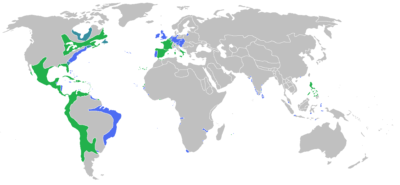
English: Locator map of the competing sides of the War of the Spanish Succession. Blue: Great Britain, Dutch Republic, Portugal with more. Green: Spain, France with more. |
| 日期 | |
| 来源 | 自己的作品 |
| 作者 | Gabagool |
许可协议
我,本作品著作权人,特此采用以下许可协议发表本作品:
本文件采用知识共享署名 3.0 未本地化版本许可协议授权。
- 您可以自由地:
- 共享 – 复制、发行并传播本作品
- 修改 – 改编作品
- 惟须遵守下列条件:
- 署名 – 您必须对作品进行署名,提供授权条款的链接,并说明是否对原始内容进行了更改。您可以用任何合理的方式来署名,但不得以任何方式表明许可人认可您或您的使用。
说明
添加一行文字以描述该文件所表现的内容
此文件中描述的项目
描绘内容
14 6 2009
文件历史
点击某个日期/时间查看对应时刻的文件。
| 日期/时间 | 缩略图 | 大小 | 用户 | 备注 | |
|---|---|---|---|---|---|
| 当前 | 2010年5月13日 (四) 13:56 | | 1,357 × 628(51 KB) | Kieran4 | Borders for Dutch East Indies corrected |
| 2010年3月26日 (五) 01:35 |  | 1,357 × 628(51 KB) | Gabagool | some further adjustments | |
| 2010年3月20日 (六) 04:29 |  | 1,357 × 628(51 KB) | Gabagool | some corrections (NA) after notice and help by User:Magicpiano | |
| 2009年6月13日 (六) 22:32 |  | 1,357 × 628(44 KB) | Gabagool | {{Information |Description={{en|1=Locator map of the competing sides of the War of the Spanish Succession.<br> Blue: Great Britain, Dutch Republic, Portugal with more. Green: Spain, France with more.<br> (Partially based on ''Atlas of World History'' (200 |
文件用途
没有页面使用本文件。
全域文件用途
以下其他wiki使用此文件:
- el.wikipedia.org上的用途
- en.wikipedia.org上的用途
- fa.wikipedia.org上的用途
- fr.wikipedia.org上的用途
- hy.wikipedia.org上的用途
- ko.wikipedia.org上的用途
- lt.wikipedia.org上的用途
- pl.wikipedia.org上的用途
- th.wikipedia.org上的用途
- uz.wikipedia.org上的用途
- vi.wikipedia.org上的用途