美罗仕般 (新南威尔士州)

来自维基百科,自由的百科全书

美羅仕般 (新南威爾斯州)map

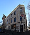
美罗仕般[1](英语:Millers Point),又译美罗士般[2]美剌盘[3],是澳洲新南威尔士州雪梨的一个内城市区,位于雪梨商业中心区的西北端,毗邻岩石区,是雪梨市地方政府行政区英语Local government in Australia的一部分。

Quick Facts 美罗仕般 Millers Point, 国家 ...
美罗仕般
Millers Point
Thumb
Thumb
美罗仕般
Thumb
美罗仕般
美罗仕般
坐标:33°50′54″S 151°12′04″E
国家 澳大利亚
一级行政区新南威尔士州
地方政府区域雪梨市
面积
 • 总计0.5 平方公里(0.2 平方英里)
邮政编码2000
位置1千米(0.62英里)
(距雪梨商业中心区西北)
城市雪梨
堂区圣腓力英语Parish of St Philip
州选区雪梨英语Electoral district of Sydney
联邦选区雪梨
Close

图集

参考

延伸阅读

外部链接

Wikiwand in your browser!

Seamless Wikipedia browsing. On steroids.

Every time you click a link to Wikipedia, Wiktionary or Wikiquote in your browser's search results, it will show the modern Wikiwand interface.

Wikiwand extension is a five stars, simple, with minimum permission required to keep your browsing private, safe and transparent.