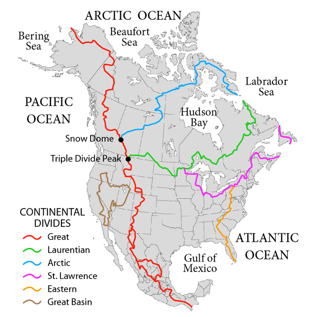
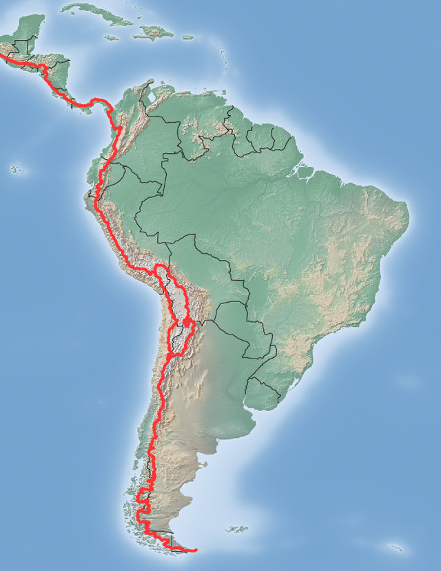
美洲大陆分水岭(英语:Continental Divide of the Americas)又称大分水岭(Great Divide)、西部分水岭(Western Divide)或大陆分水岭(Continental Divide),是南北美洲大陆西端组成连续分水岭的一系列山脊,将大陆内水系流域大致分隔成太平洋出海口的水系与大西洋(包括墨西哥湾和加勒比海)/北冰洋(包括哈德森湾)出海的水系。美洲大陆分水岭北起阿拉斯加在白令海峡沿岸的威尔士王子角,往西南经过加拿大育空地区和不列颠哥伦比亚省、美国的蒙大拿州、怀俄明州、科罗拉多州和新墨西哥州、以及墨西哥大部分地区,然后通过中美洲到南美洲与安地斯山脉相连,一直延伸到麦哲伦海峡沿岸的弗罗厄德角。


外部链接
- A detailed map of watersheds in North America (页面存档备份,存于互联网档案馆)
- A detailed overview of isolated wetlands from the USFWS (页面存档备份,存于互联网档案馆)
- Detailed article, maps, and boundary data from The National Atlas of the United States
- Parting of the Waters: a creek that flows to two oceans
Wikiwand in your browser!
Seamless Wikipedia browsing. On steroids.
Every time you click a link to Wikipedia, Wiktionary or Wikiquote in your browser's search results, it will show the modern Wikiwand interface.
Wikiwand extension is a five stars, simple, with minimum permission required to keep your browsing private, safe and transparent.
