北斯德布鲁克岛
来自维基百科,自由的百科全书
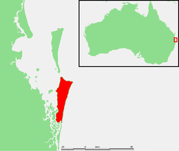
北斯德布鲁克岛(North Stradbroke Island)是位于澳大利亚昆士兰州首府布里斯班以东30公里处的一个岛屿,也是世界面积第二大的沙洲[1]。在1896年之前,北斯德布鲁克岛是斯德布鲁克岛的一部分。但这一年的一场大风暴将斯德布鲁克岛分为南北两部分。北斯德布鲁克岛南北长38公里,东西宽12公里。岛上的主要产业是旅游业。
| North Stradbroke Island | |
|---|---|
Minjerribah 绰号:Straddie | |
 | |
 | |
| 自然地理 | |
| 坐标 | 27°35′S 153°28′E |
| 所处海域 | 摩顿湾 |
| 总面积 | 275.2平方千米(106.3平方英里) |
| 长度 | 38千米(23.6英里) |
| 宽度 | 11千米(6.8英里) |
| 最高海拔 | 239米(784英尺) |
| 管辖 | |
| 澳大利亚 | |
| 州 | 昆士兰州 |
| 区 | 黄金海岸、东南昆士兰 |
| 地方政府区 | Redland City |
| 居民 | |
| 人口 | 2,030 |
| 族群 | Quandamooka人 |
参考资料
Wikiwand - on
Seamless Wikipedia browsing. On steroids.
