File:Woking_Town_Square_-_geograph.org.uk_-_40908.jpg
维基百科,自由的 encyclopedia
此为最大尺寸。
Woking_Town_Square_-_geograph.org.uk_-_40908.jpg (640 × 427像素,文件大小:85 KB,MIME类型:image/jpeg)
摘要
| 描述Woking Town Square - geograph.org.uk - 40908.jpg |
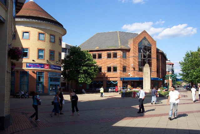
English: Woking Town Square. In 1838 when the railway arrived, Woking town centre was open heathland. The town developed in a fairly piecemeal fashion and had reached a form of completion by the mid-1980s, when redevelopment began again. A short-lived town centre swimming pool disappeared as part of those changes, to be replaced by the Pool in the Park. The present form of the town centre, including the modern library, the Peacocks shopping centre, and the refashioned Wolsey Way centre date from that time. |
| 日期 | |
| 来源 | From geograph.org.uk |
| 作者 | Ron Strutt |
| 署名 (由许可协议要求) InfoField | Ron Strutt / Woking Town Square / |
InfoField | Ron Strutt / Woking Town Square |
| 物体位置 | 51° 19′ 北, 0° 34′ 西 | 在以下服务上查看本图像和附近其他图像: OpenStreetMap |
|---|
许可协议

|
本文件采用知识共享署名-相同方式共享 2.0 通用许可协议授权。
署名: Ron Strutt
- 您可以自由地:
- 共享 – 复制、发行并传播本作品
- 修改 – 改编作品
- 惟须遵守下列条件:
- 署名 – 您必须对作品进行署名,提供授权条款的链接,并说明是否对原始内容进行了更改。您可以用任何合理的方式来署名,但不得以任何方式表明许可人认可您或您的使用。
- 相同方式共享 – 如果您再混合、转换或者基于本作品进行创作,您必须以与原先许可协议相同或相兼容的许可协议分发您贡献的作品。
- Remove redundant categories and try to put this image in the most specific category/categories
- Remove this template
- The location categories are based on information from this geonames tool and this OpenStreetMap tool combined with a database. You can also have a look at this tool from mysociety.
- The topic category from Geograph was Town centre (find similar images centre at Geograph)
English | suomi | français | galego | עברית | magyar | македонски | മലയാളം | português | português do Brasil | Türkçe | +/−
说明
添加一行文字以描述该文件所表现的内容
此文件中描述的项目
描绘内容
知识共享署名-相同方式共享2.0通用 简体中文(已转写)
文件来源 简体中文(已转写)
21 8 2005
描述地坐标 中文(已转写)
51°19'1"N, 0°33'36"W
文件历史
点击某个日期/时间查看对应时刻的文件。
| 日期/时间 | 缩略图 | 大小 | 用户 | 备注 | |
|---|---|---|---|---|---|
| 当前 | 2010年1月30日 (六) 20:29 | | 640 × 427(85 KB) | GeographBot | == {{int:filedesc}} == {{Information |description={{en|1=Woking Town Square. In 1838 when the railway arrived, Woking town centre was open heathland. The town developed in a fairly piecemeal fashion and had reached a form of completion by the mid-1980s, |
文件用途
以下页面使用本文件:
全域文件用途
以下其他wiki使用此文件:
- af.wikipedia.org上的用途
- azb.wikipedia.org上的用途
- az.wikipedia.org上的用途
- ceb.wikipedia.org上的用途
- cs.wikipedia.org上的用途
- en.wikipedia.org上的用途
- fa.wikipedia.org上的用途
- fi.wikipedia.org上的用途
- hu.wikipedia.org上的用途
- ja.wikipedia.org上的用途
- ko.wikipedia.org上的用途
- lld.wikipedia.org上的用途
- nl.wikipedia.org上的用途
- nn.wikipedia.org上的用途
- no.wikipedia.org上的用途
- pl.wikipedia.org上的用途
- pl.wikivoyage.org上的用途
- simple.wikipedia.org上的用途
- sv.wikipedia.org上的用途
- szl.wikipedia.org上的用途
- ur.wikipedia.org上的用途
元数据
此文件中包含有扩展的信息。这些信息可能是由数码相机或扫描仪在创建或数字化过程中所添加。
如果此文件的源文件已经被修改,一些信息在修改后的文件中将不能完全反映出来。
| 相机制造商 | EASTMAN KODAK COMPANY |
|---|---|
| 相机型号 | KODAK DX4330 DIGITAL CAMERA |
| 曝光时间 | 1/500秒(0.002) |
| 光圈值 | f/4.8 |
| 数据生成日期时间 | 2005年8月21日 (日) 16:33 |
| 镜头焦距 | 8毫米 |
| 方向 | 正常 |
| 水平分辨率 | 230 dpi |
| 垂直分辨率 | 230 dpi |
| 亮度(Y)和色度(C)位置 | 中间 |
| 曝光程序 | 普通程序 |
| Exif版本 | 2.2 |
| 数字化日期时间 | 2005年8月21日 (日) 16:33 |
| APEX快门速度 | 9 |
| APEX光圈 | 4.5 |
| APEX曝光补偿 | 0 |
| 最大光圈 | 3 APEX(f/2.83) |
| 测光模式 | 平均 |
| 光源 | 未知 |
| 闪光灯 | 闪光灯未点亮、闪光灯强制关闭 |
| 色彩空间 | sRGB |
| 曝光指数 | 120 |
| 感光方法 | 单芯片彩色区域传感器 |
| 自订图像处理 | 普通处理 |
| 曝光模式 | 自动曝光 |
| 白平衡 | 自动白平衡 |
| 数字变焦比率 | 0 |
| 35毫米胶片焦距 | 38毫米 |
| 场景拍摄类型 | 标准 |
| 对比度 | 标准 |
| 饱和度 | 标准 |
| 锐度 | 标准 |
| 拍摄对象距离范围 | 未知 |