File:Soho_-_map_1.png
维基百科,自由的 encyclopedia
Soho_-_map_1.png (626 × 525像素,文件大小:422 KB,MIME类型:image/png)
| 描写Soho - map 1.png |
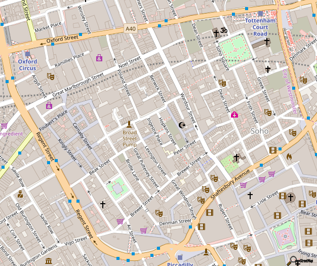
Map of Soho, London 本London 的地圖以OpenStreetMap計畫資料建立,由社群收集。 此地圖可能不完整,也可能包含錯誤。別只用它當導航。 |
|||||||||
| 日期 | ||||||||||
| 来源 | 您可以在Soho的OpenStreetMap wiki頁面找到有關頁面 | |||||||||
| 创作作者 |
OpenStreetMap 貢獻者 |
|||||||||
| 授权 (二次使用本文件) |
OpenStreetMap的資料依據開放資料庫授權條款(細節)提供。圖磚採用創用CC姓名標示-相同方式分享 2.0(CC-BY-SA 2.0)條款授權。
本文件采用知识共享署名-相同方式共享 2.0 通用许可协议授权。
|
|||||||||
| Geotemporal data | ||||||||||
| 边框 |
|
|||||||||
| 地理参考 | 地理参考Wikimaps Warper中的地图 如果不适当,请设置 warp_status = skip 为隐藏。 | |||||||||
To see a more up-to-date OpenStreetMap view of this area: http://www.openstreetmap.org/#map=16/51.5129/-0.1343
...or generate this exact image: http://staticmap.openstreetmap.de/staticmap.php?center=51.5131,-0.13546&zoom=16&size=626x525
This map is available as SVG from the OpenStreetMap-Server however the file is 4.3MB big and uses 1.2GB of RAM for rendering in Inkscape 0.46, so it's better to keep this version. Here's the SVG link: http://tile.openstreetmap.org/cgi-bin/export?bbox=-0.14283,51.50958,-0.12871,51.51714&scale=6800&format=svg
说明
此文件中描述的项目
描绘内容
知识共享署名-相同方式共享2.0通用 简体中文(已转写)
文件历史
点击某个日期/时间查看对应时刻的文件。
| 日期/时间 | 缩略图 | 大小 | 用户 | 备注 | |
|---|---|---|---|---|---|
| 当前 | 2018年10月29日 (一) 14:06 | | 626 × 525(422 KB) | Wvdp | updates from osm |
| 2017年12月23日 (六) 18:05 |  | 626 × 525(415 KB) | Wvdp | update | |
| 2015年11月2日 (一) 11:57 |  | 626 × 525(396 KB) | FranklyMyDear... | Significant cartographic style change to the roads | |
| 2015年7月14日 (二) 21:55 |  | 626 × 525(360 KB) | Harry Wood | update for 2015 with improved building coverage in the map data + more recent 'standard' OpenStreetMap style. Also "improving the resolution" back again closer to the native resolution | |
| 2013年1月5日 (六) 01:00 |  | 2,248 × 1,735(2.12 MB) | John Aplessed | Improved resolution, updated design and contents, imaged zoomed out one level (original zoom level doesn't exist) | |
| 2008年1月9日 (三) 06:01 |  | 626 × 525(151 KB) | Grenavitar | version without 401 label messed up | |
| 2007年12月18日 (二) 16:23 |  | 601 × 531(145 KB) | IgnoredAmbience | ||
| 2007年2月27日 (二) 01:35 |  | 620 × 511(65 KB) | Edward | {{Information |Description=Map of w:Soho |Source=OpenStreetMap |Date=2007-02-27 |Author=Edward Betts |Permission={{cc-by-sa-2.0}} }} Category:Maps of London Category:OpenStreetMap maps |
文件用途
以下页面使用本文件:
全域文件用途
以下其他wiki使用此文件:
- ar.wikipedia.org上的用途
- be.wikipedia.org上的用途
- bg.wikipedia.org上的用途
- ceb.wikipedia.org上的用途
- da.wikipedia.org上的用途
- de.wikipedia.org上的用途
- el.wikipedia.org上的用途
- en.wikipedia.org上的用途
- en.wikinews.org上的用途
- eo.wikipedia.org上的用途
- fa.wikipedia.org上的用途
- he.wikipedia.org上的用途
- id.wikipedia.org上的用途
- ja.wikipedia.org上的用途
- km.wikipedia.org上的用途
- kn.wikipedia.org上的用途
- ko.wikipedia.org上的用途
- no.wikipedia.org上的用途
- pl.wikipedia.org上的用途
- ru.wikipedia.org上的用途
- simple.wikipedia.org上的用途
- si.wikipedia.org上的用途
- sk.wikipedia.org上的用途
- sl.wikipedia.org上的用途
- sr.wikipedia.org上的用途
- te.wikipedia.org上的用途
- tr.wikipedia.org上的用途
- uk.wikipedia.org上的用途
- war.wikipedia.org上的用途
- www.wikidata.org上的用途
元数据
此文件中包含有扩展的信息。这些信息可能是由数码相机或扫描仪在创建或数字化过程中所添加。
如果此文件的源文件已经被修改,一些信息在修改后的文件中将不能完全反映出来。
| 水平分辨率 | 37.8 dpc |
|---|---|
| 垂直分辨率 | 37.8 dpc |